A treatise on Threapwood's watercourses : Confluences and Meanderings
By Chris Bennion
Background
On behalf of the Threapwood History Group, this work sets out to explore the local watercourses, their history and associated structures. Information relating to the geology of the area’s strata is offered in broad terms, but the essence is to portray the numerous structures that control flows and form the road and footpath crossings essential to today’s travel and recreational needs.
Enquiries for information to Cheshire West and Cheshire Council resulted in referral to the Environment Agency (EA), who duly referred back to the Council. As the watercourses in the vicinity of Threapwood are not designated as statutory main rivers, the EA do not hold information relating to water flows or associated structures. Information for this work has been sourced from the Records Office at Hawarden, various text books, many local people and by observation. A commentary accompanies many of the photos, most of which have been taken during the recent winter period as foliage tends to hide many features of interest.
Any portrayal of land adjacent to watercourses seen in the accompanying photographs is to be considered as incidental to the purpose of this work.
The watercourses are described individually, from their upstream source within the Threapwood area and are followed downstream to where they either merge with other watercourses or leave the area. These are journeys to be explored and enjoyed, no matter what the season.
Overview
The road between Shocklach and Tallarn Green traverses the contours of three distinct valleys. These valleys have been formed over time by Threapwood’s main watercourses, each of which flow in an approximate East to Westerly direction before joining the River Dee’s floodplain North of Worthenbury. All feature gentle curving changes in direction called meanders, caused by gradual erosion and re-deposition of bank materials. The valleys have been cut through the relatively soft boulder clay deposits that overlie porous sandstone bedrock. Parts of these valleys are now designated as Nature Conservation areas and include Sites of Special Scientific Interest and Sites of Biological Importance. The meanders and valleys indicate the watercourses have existed for a significant period of time.
Studies of river meanders in the Dee valley have shown that the River Dee occupied a position close to its present location shortly after the last glaciation, in the process cutting down into the underlying glacial till and creating various landforms and sediments including at least two river terraces and leaving a discontinuous complex of abandoned river channels, meander cut-offs and oxbow lakes. Archaeological and sedimentary evidence suggests that the course of the river has been relatively stable since later prehistoric or Roman times, with many of the meander cut-offs being infilled during the medieval period and with evidence of increasing management of flow regulation since about 1700.[3]
Threapwood’s watercourses are known as Flennen’s Brook, Paradise Brook and Wych Brook.
Flennen’s Brook
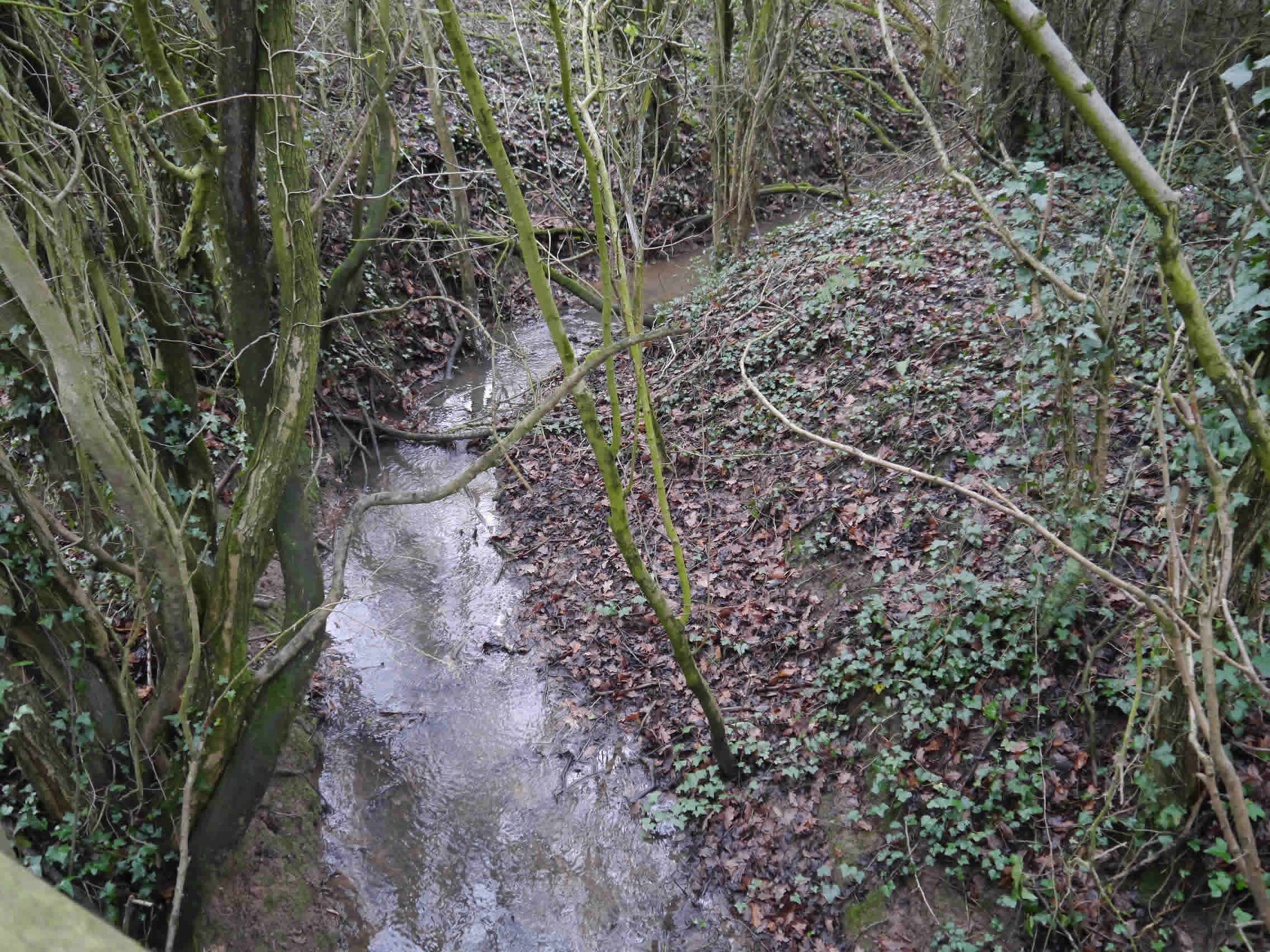
Most of Threapwood’s Northern boundary is defined by Flennen's Brook. This watercourse rises to the East of Dog Lane Farm and runs in a ditch South of Dog Lane before crossing the lane in a piped culvert. A timber footbridge crosses the brook South of Tinkwood. A tributary rising in the fields near Cuddington Hall is piped under Crabtree Lane and Tinkwood Lane and forms a confluence with Flennen’s Brook about 50 metres to the South of the Wrexham Road near The Bank. Flennen’s Brook crosses beneath Wrexham Road in a brick lined culvert before continuing to the Dingle plantation and crossing beneath the road to Shocklach in a recently rebuilt box culvert. Over the 2.2km between Doglane Farm and the Shocklach Road culvert the brook falls at an average gradient of about 1 in 55. The brook subsequently joins Worthenbury Brook near Shocklach Hall en-route to the River Dee.
This watercourse is named Flanings Brook on the Peter Burdott map of 1777 [5]. However the Ordnance Survey map of 1872 notes Flennen's Brook. There is an unconfirmed theory that the name Flennen originates as a derivation of Saint Flannán, a 7th century Irish Catholic consecrated as 1st Bishop of Killaloe following a pilgrimage to Rome.
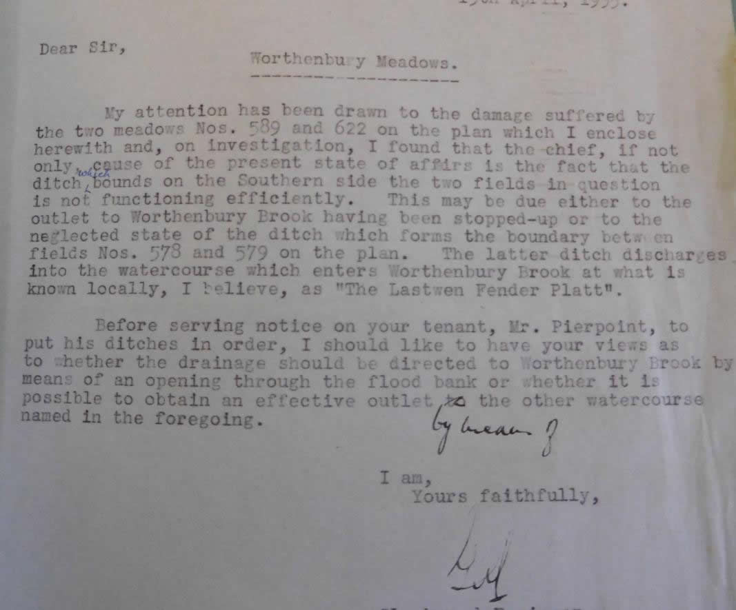 |
| An interesting letter, dated 13 April 1935 from Gerald Wright (Clerk and Engineer for River Dee, Middle Level Drainage Board) to John Howard of Broughton Hall, relating to unmaintained ditches. |
Geological surveys on Flennen’s Brook include the following: Small exposures of Keuper Sandstone Conglomerate and fine grained brown sandstone in Flennen’s Brook 200m and 300m South of Wrexham Road [1]. (Keuper is the former name of a layer of rock strata formed during the Triassic period – now known as the Helsby Sandstone Formation). Along with the Chester Pebble Beds, the Helsby Sandstone represents one of the most important and widespread Triassic red-coloured sandstones used as a building stone in Cheshire.
This formation covers an extensive area in Cheshire and it forms much of the high ground of the mid Cheshire Hills, although the outcrop is faulted and discontinuous. In south Cheshire the beds occur in a North East-South West trending narrow belt between Threapwood and Broxton [2]. Along Flennen’s Brook, from 250m East of Topwood, medium and fine grained sandstones extend upstream in a series of folded and veined isolated exposures as far as the site of the old brick and tile works. These sandstones are also exposed in Paradise Brook [1].
 |
| Pic 1 Visible source of Flennen’s Brook outside Dog Lane Farm |
 |
| Pic 2 Ditch on South side of Dog Lane. Crabtree Lane on the left. |
 |
| Pic 3 Piped outfall under Dog Lane North side |
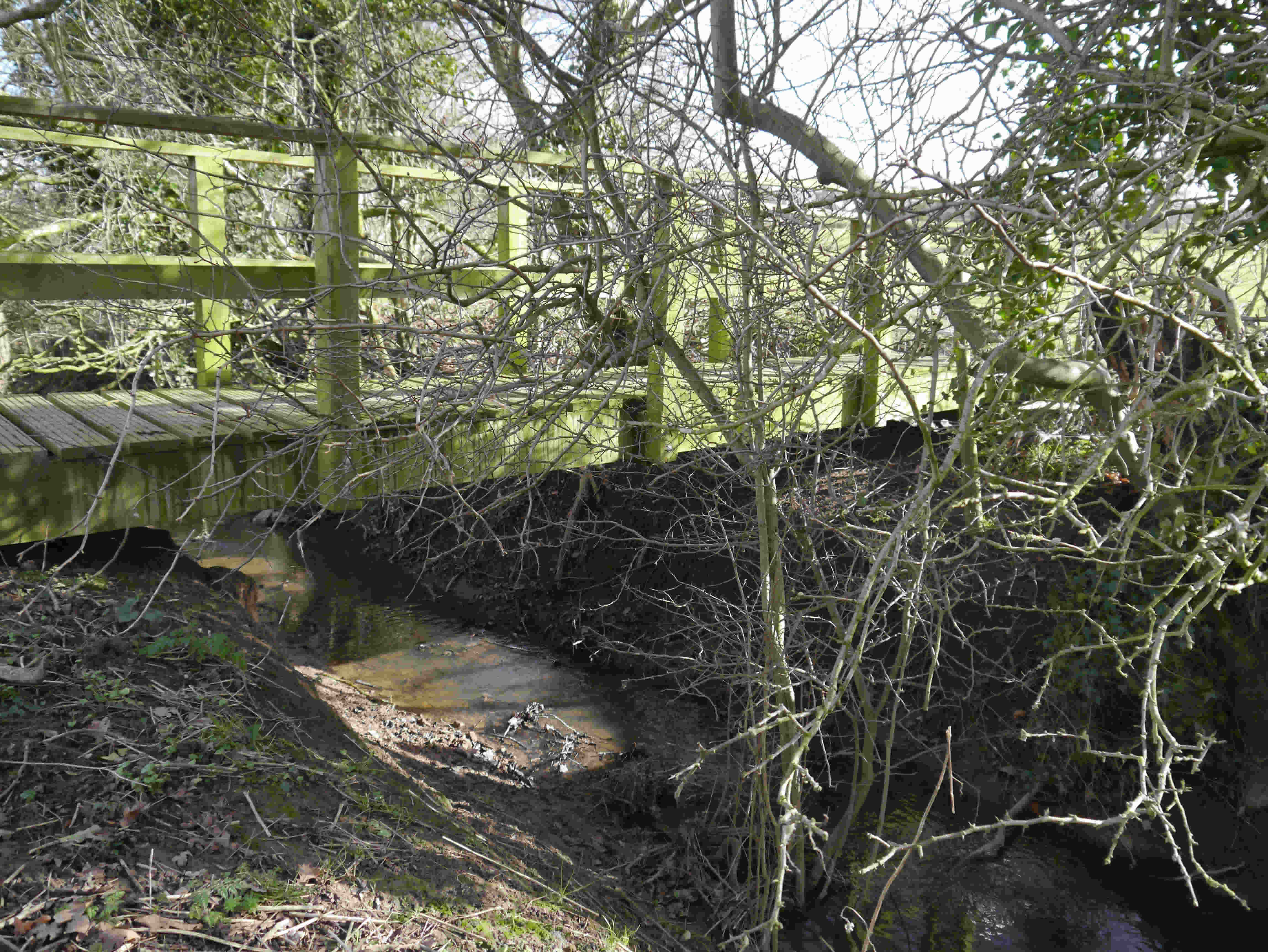
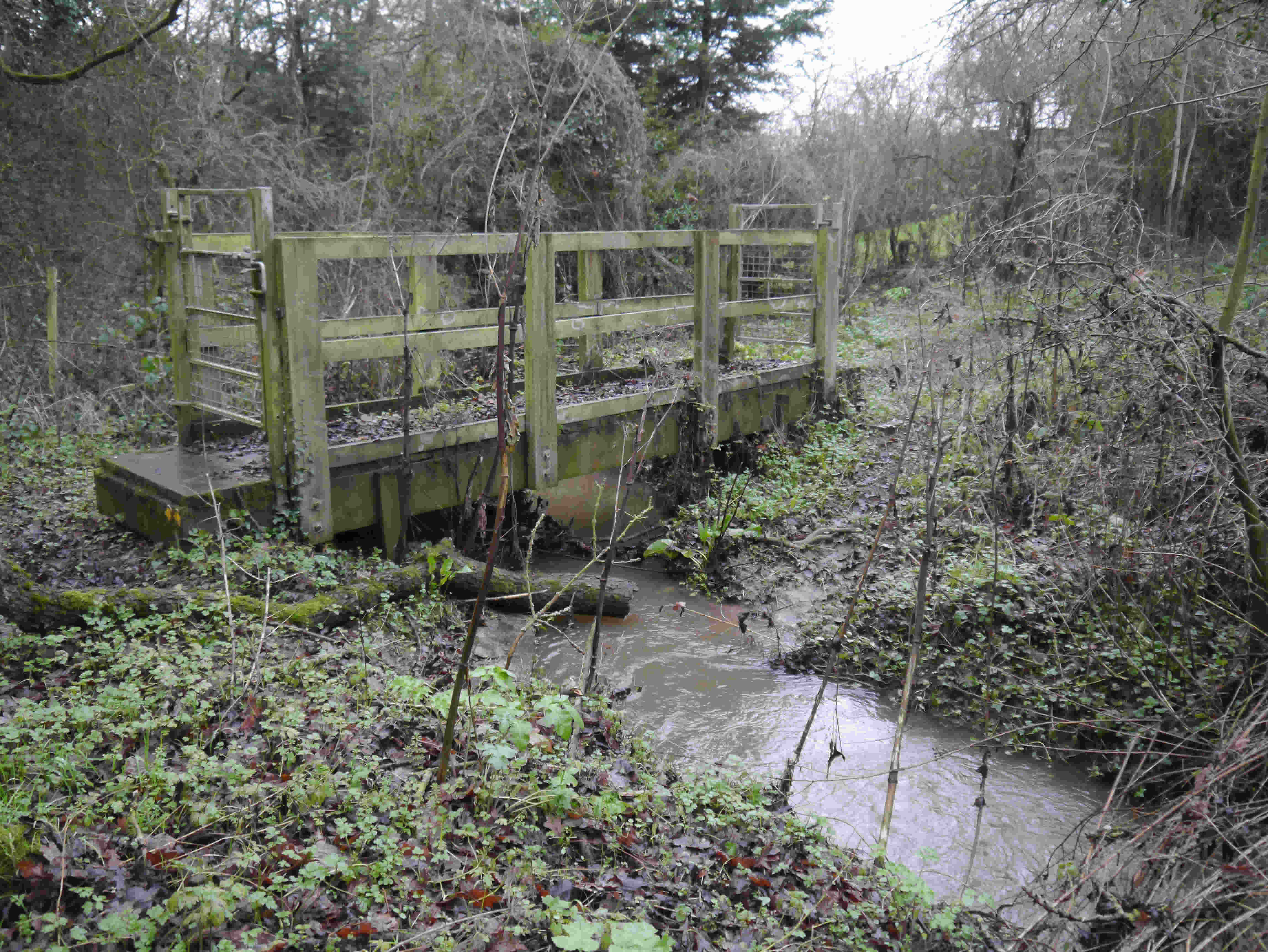 |
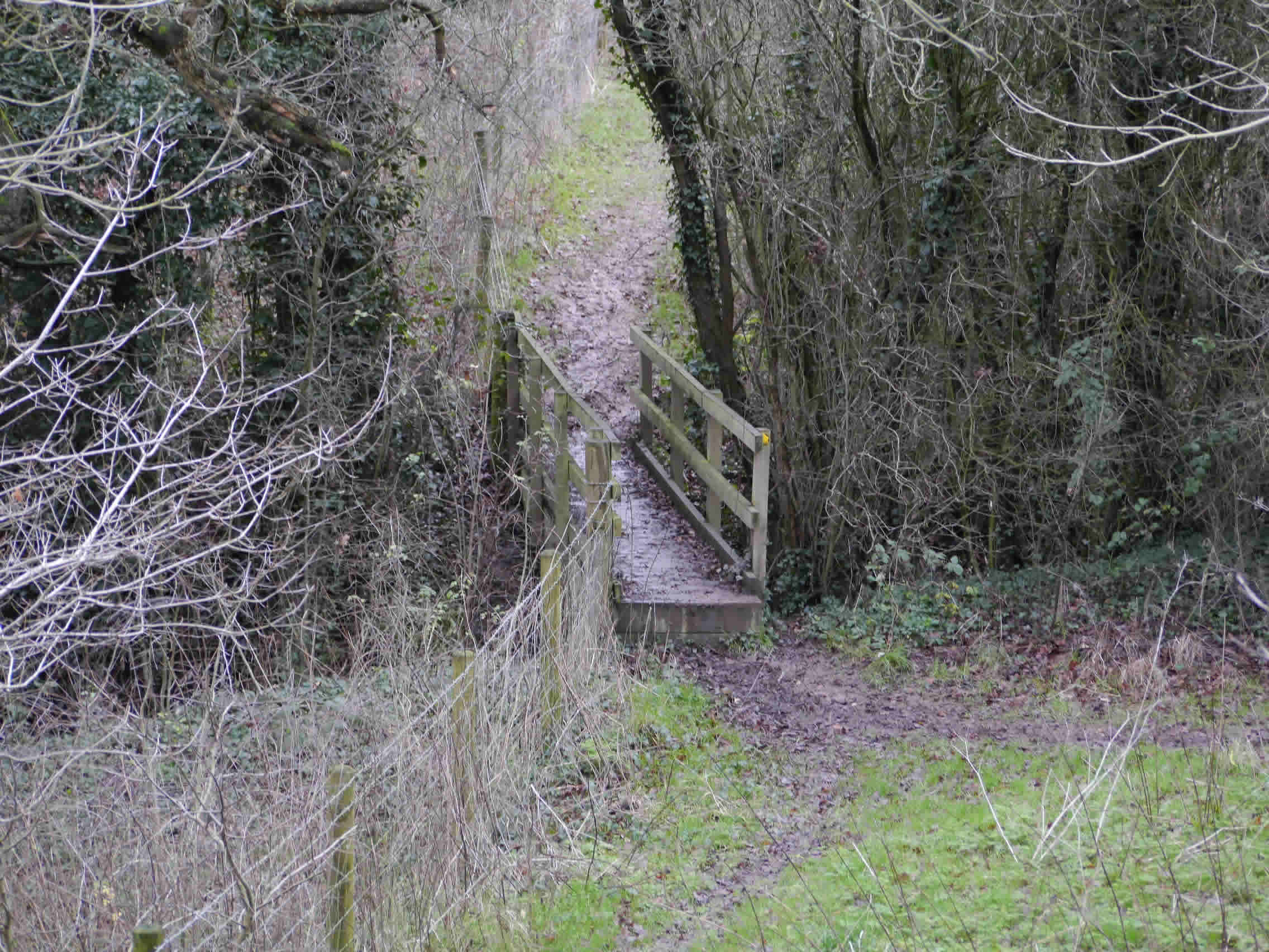
Pic 4 Tinkwood Footbridge Footpath FP09 between Oldcastle Lane and Tinkwood. Timber bridge with recent steel latched gates at both sides. An old timber sleeper crossing remains to the West of the bridge. |
 |
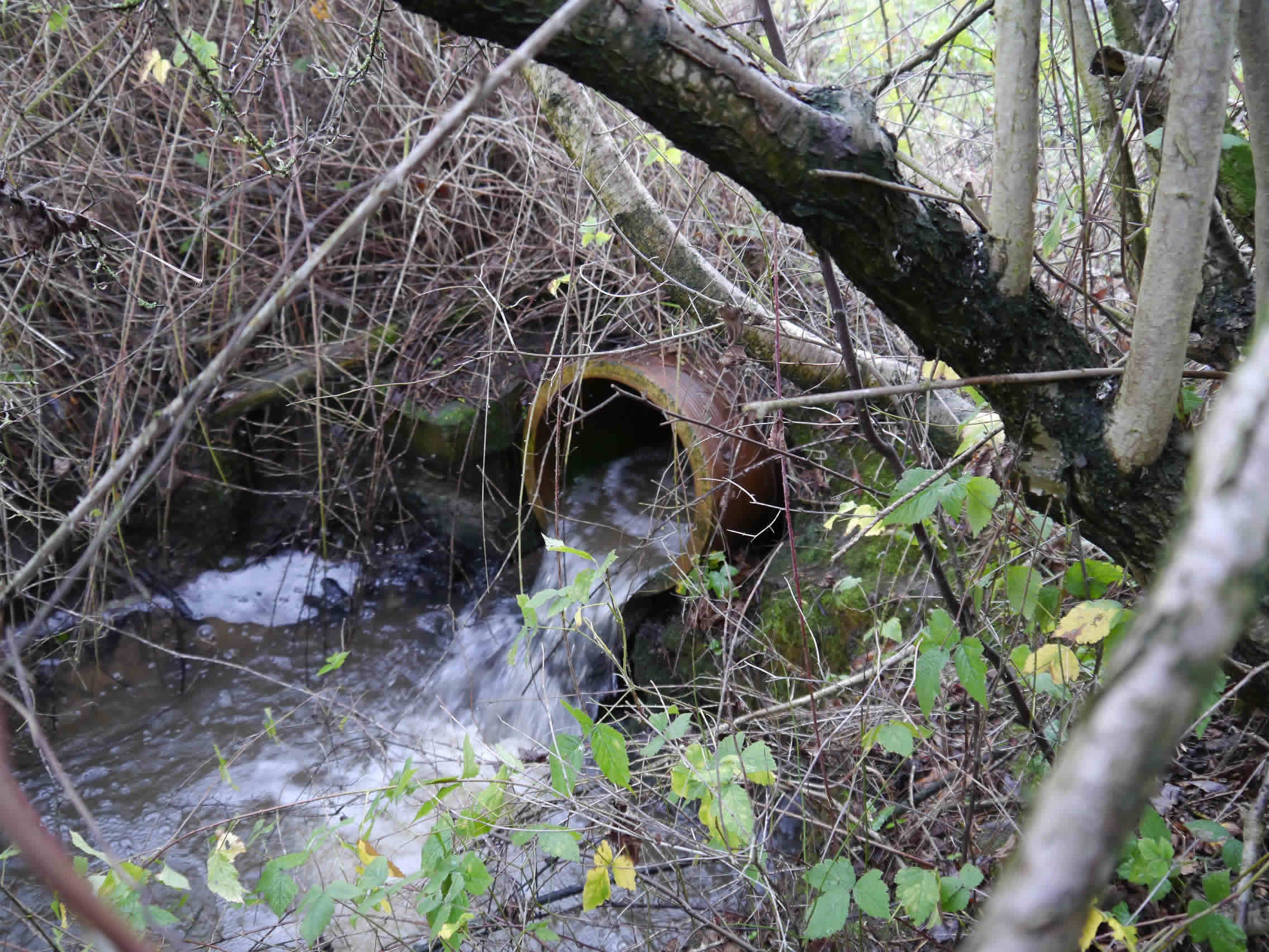
| Pic 5 Flennen’s tributary piped outfall on West side of Tinkwood Lane |
 |
| Pic 6Confluence of tributary (left) and Flennen’s Brook (right), South of Wrexham Road |
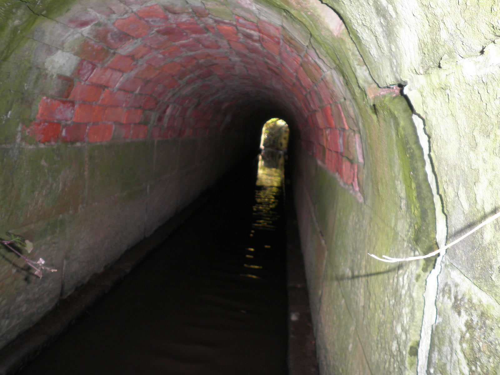 |
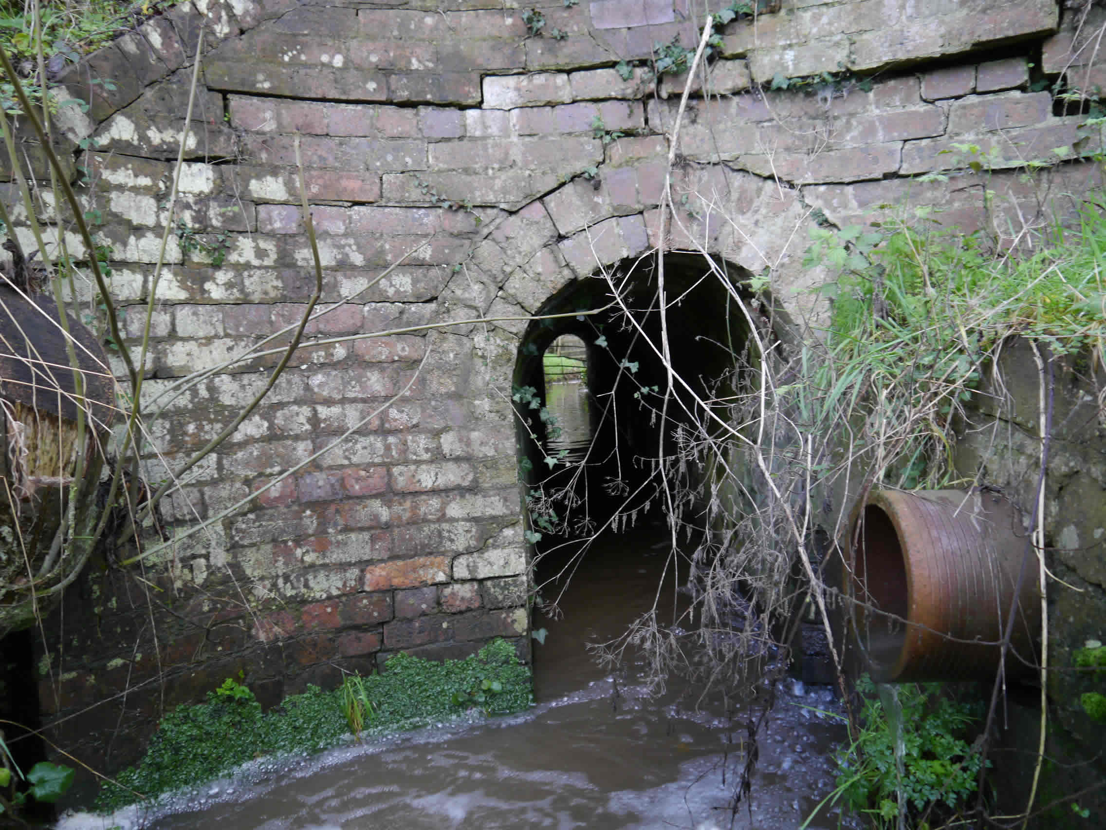
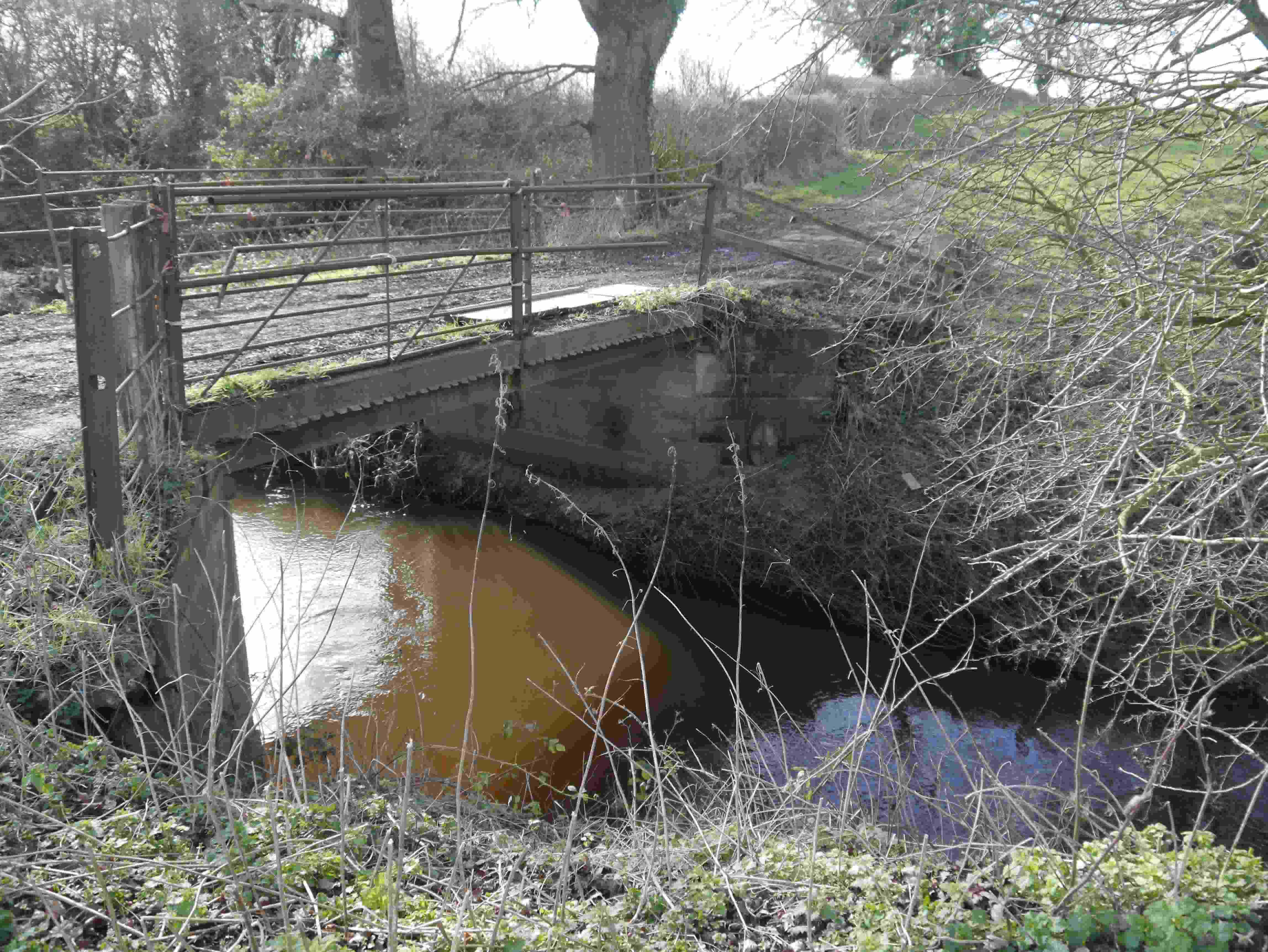
| Pic 7 Wrexham Road culvert . View from South portal. |
 |
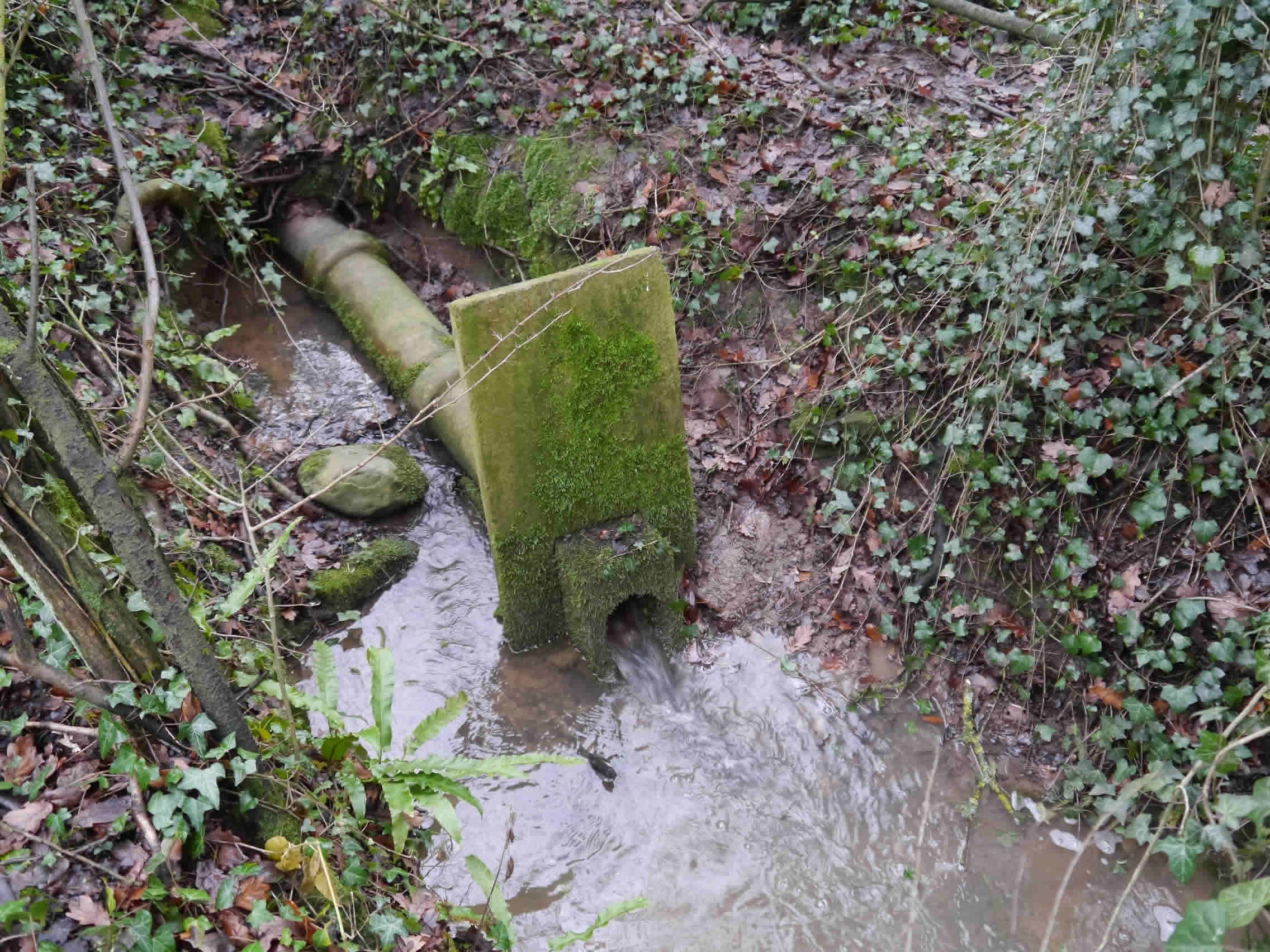
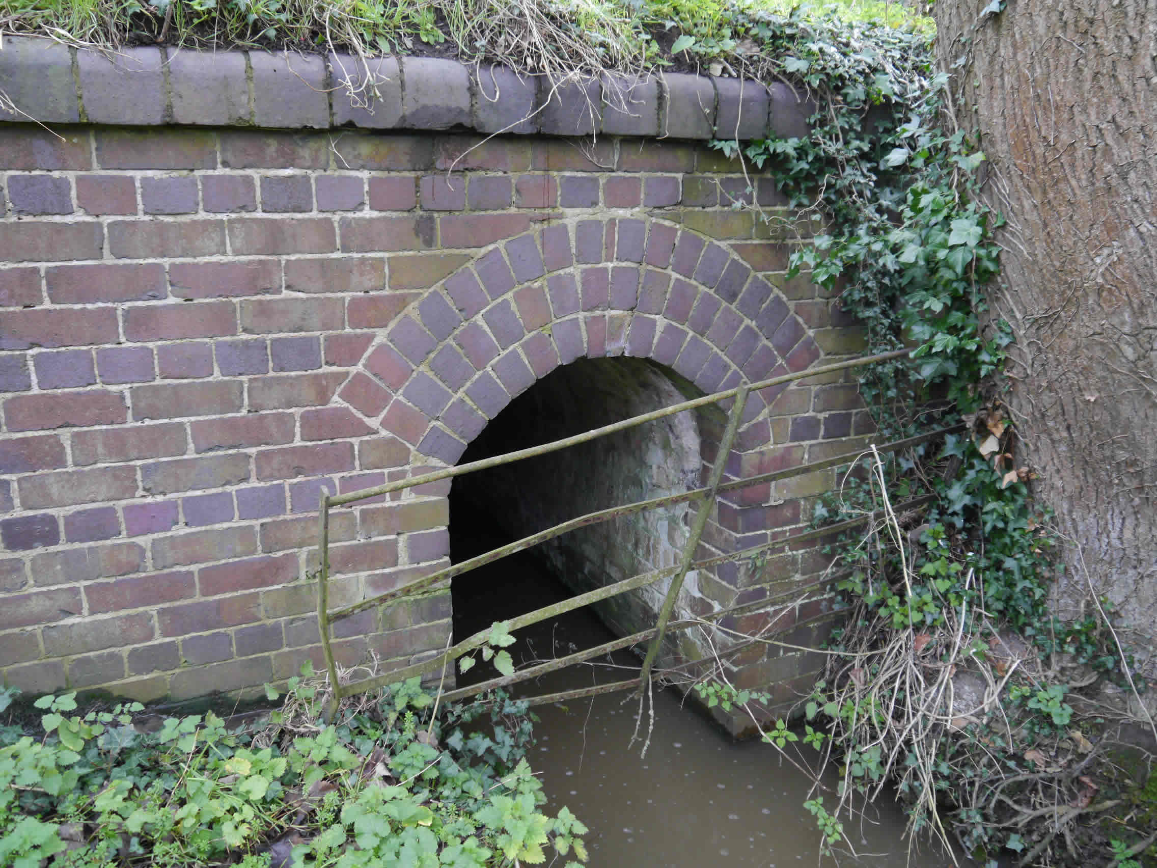
| Pic 8 Wrexham Road Culvert North Headwall |
 |
Pic 9 Inscription on North East wall. An inscription carved into the sandstone at the mouth of the culvert on the North East side reads: Joseph Gregory Surveyor AD 1822 |
Research by Dorothy Powell of the History Group has revealed Joseph Gregory was credited with an 1839 map and survey of Shocklach and surrounding area containing footpaths, bridleways, waterbodies, houses, woods and open fields (extract below). At the time of his death in 1849 he was registered as a ‘Gent’ of Worthenbury.
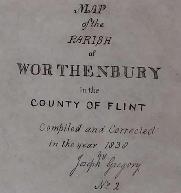 |
| Extract from 1839 Joseph Gregory Tithe map of Worthenbury |
Paradise Brook
Providing a natural separation between Upper and Lower Threapwood is Paradise Brook. This is formed by the merging of three feeders that rise from the fields and ponds between The Greaves and Topwood.
Paradise Brook is noted in 1831 bry v paradis broc. The location of this ‘paradise’ in Oldcastle or Threapwood is unknown. [4]
For purposes of this exercise these feeders are called North, Middle and South. Large ponds, on the site of the old brick works, interlink to feed the North feeder that flows via a ditch adjacent to the public footpath along a field boundary. The Middle feeder flows from a pond in a wooded area linked via pipes to ditches on both sides of the bridlepath leading to Dymocks Mill Lane . The South feeder flows from a piped outfall to the North of the public footpath between Greaves Lane and Oldcastle Lane.
Several kettle holes exist on the Greaves fields, formed by the in-situ melting of ice-blocks during deglaciation about 20,000 years go. About 600 metres South East of its passage beneath Sarn Road near St John’s church, Paradise Brook joins Wych Brook.
 |
| Pic 10 North feeder in ditch between fields |
 |
| Pic 11 Middle feeder in woodland |
 |
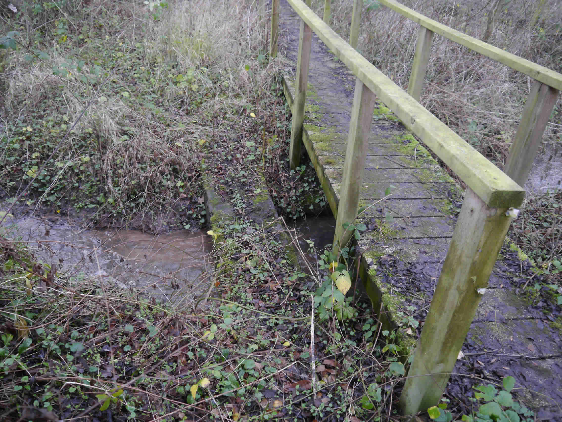
| Pic 12 Middle feeder footbridge on Greaves Lane - Oldcastle Lane footpath |
 |
| Pic 13 South feeder outfall, North of public footpath |
 |
| Pic 14 South feeder |
 |
| Pic 15 South feeder Footbridge on Greaves Lane to Oldcastle Lane footpath |
 |
| Pic 16 Footbridge on Drumbers to Mill House footpath. This is a relatively recent timber structure. Older timber sleepers remain on the West side. |
 |
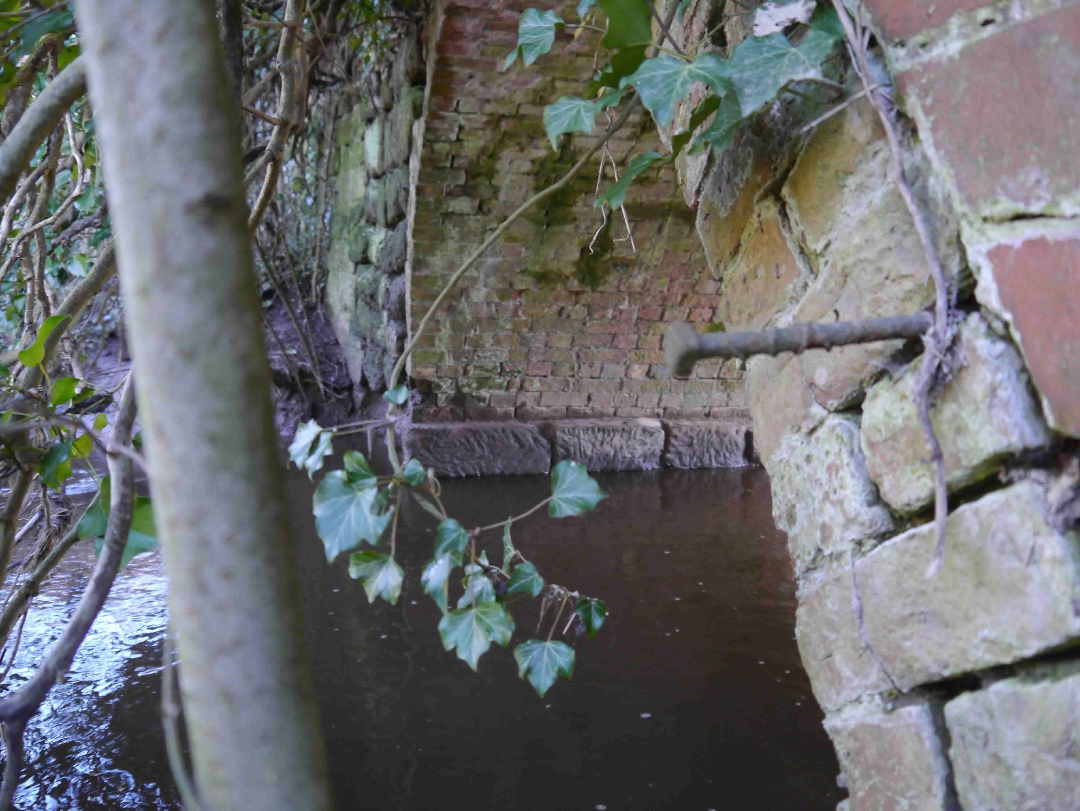
| Pic 17 Sarn Road Culvert East headwall A pond has formed within the brook on the East side of the Sarn Road and a small weir exists at the mouth of the culvert. The headwall is of engineering brick construction in a quasi-English Garden Wall bond and appears to be at least 100 years old. The road appears to have been raised up on a mound as it crosses the brook to minimise the gradient on both sides. An 1873 map of Flintshire notes ‘Threapwood Vicarage Bridge’ at this location. |
 |
Pic 18 Sarn Road culvert West headwall Over the 0.75km from the joining of its three feeder streams to the Sarn Road culvert, the brook falls at an average gradient of about 1 in 35. West of Sarn Road, the brook is in a ditch forming the boundary between fields before flowing into the Wych Brook. |
 |
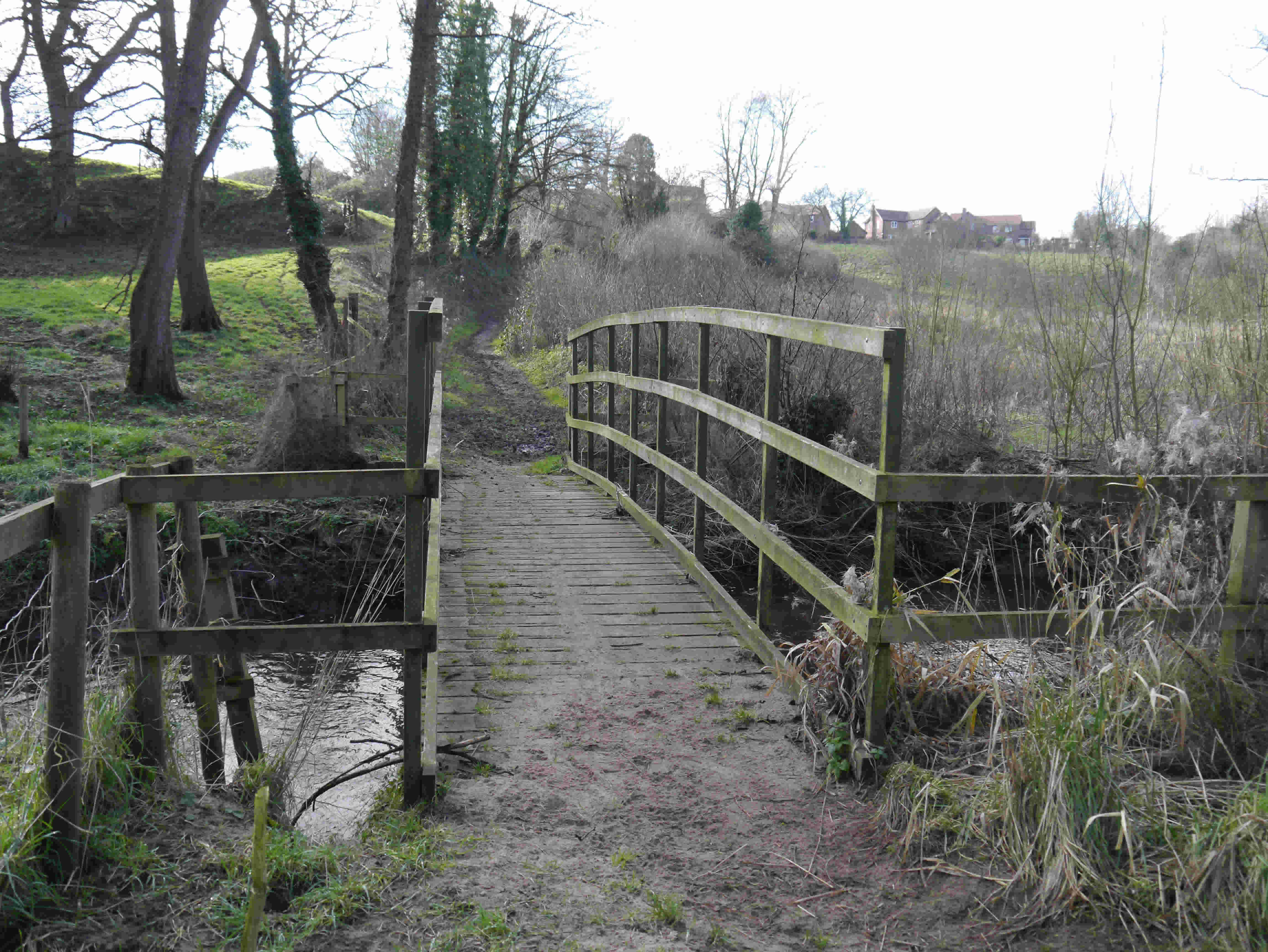
| Pic 19 Footbridge over Paradise Brook on the Sarn to Caenant Wood footpath |
Wych Brook
This is the largest of Threapwood’s watercourses and most of Threapwood’s Southern boundary is defined by Wych Brook. The cul-de-sac in Tallarn Green named Elk View reflects a former name for the brook, although River Elfe also appears in research. This watercourse rises at Fenn’s Moss near Whixall [6] and enters Threapwood via the Greaves Woods valley, navigates the weir at the Mill and flows under the Sarn Bridge before progressing in open rolling fields towards Worthenbury. A small un-named brook, running parallel and to the South of the main Tallarn Green Road, joins Wych Brook to the West of Sarn Bridge. Paradise Brook joins South of Caenant Wood. Finally, Wych Brook joins Emral Brook to become Worthenbury Brook South of the Worthenbury bridge.
Thomas Pennant in his Tour in Wales published in 1784 made particular mention of the 'venerable oaks, the remains of the ancient forest' near Threapwood. [3] The Greaves Woods, on the North side of Wych Brook, are likely to be related.
There is a theory that the Wych Brook was originally crossed either at a ford or a bridge structure some way to the East of the existing Sarn Bridge. The road would have descended past the front of Rock Cottage, before crossing onto what is now Butler’s Yard and rising to pass close to the old properties that are set back from the North side of the main Tallarn Green road. This theory is supported by the discovery of cobbled portions of road in Butler’s Yard and the location of the old houses.
The Sarn Mill was, until the mid 1980s, set on an island formed by Wych Brook to the North and a channel cut to the South. A culvert has since replaced the channel.
Over the 0.5km between the Warway bridge to the Sarn Bridge, the brook falls at an average gradient of about 1 in 75.
In recent times the brook has flooded at Sarn during October 2000 (see photo) and again in July 2007.
Keuper Sandstone is exposed on the upthrow side of the Althrey-Threapwood fault in the old quarry near Rock Villa on the Sarn Road [1]. (Althrey is near the Bangor on Dee racecourse)
 |
|
Pic 20 Bridle path bridge on the Warway between Tallarn Green and Greaves Woods. A recently fabricated steel structure with timber guardrails, all on blockwork abutments. |
 |
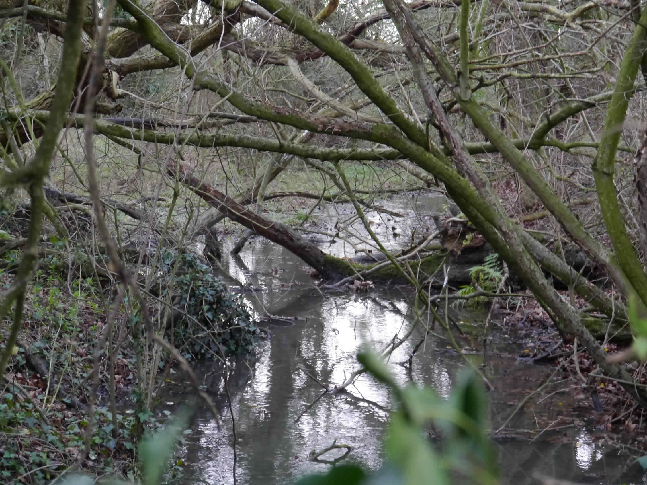
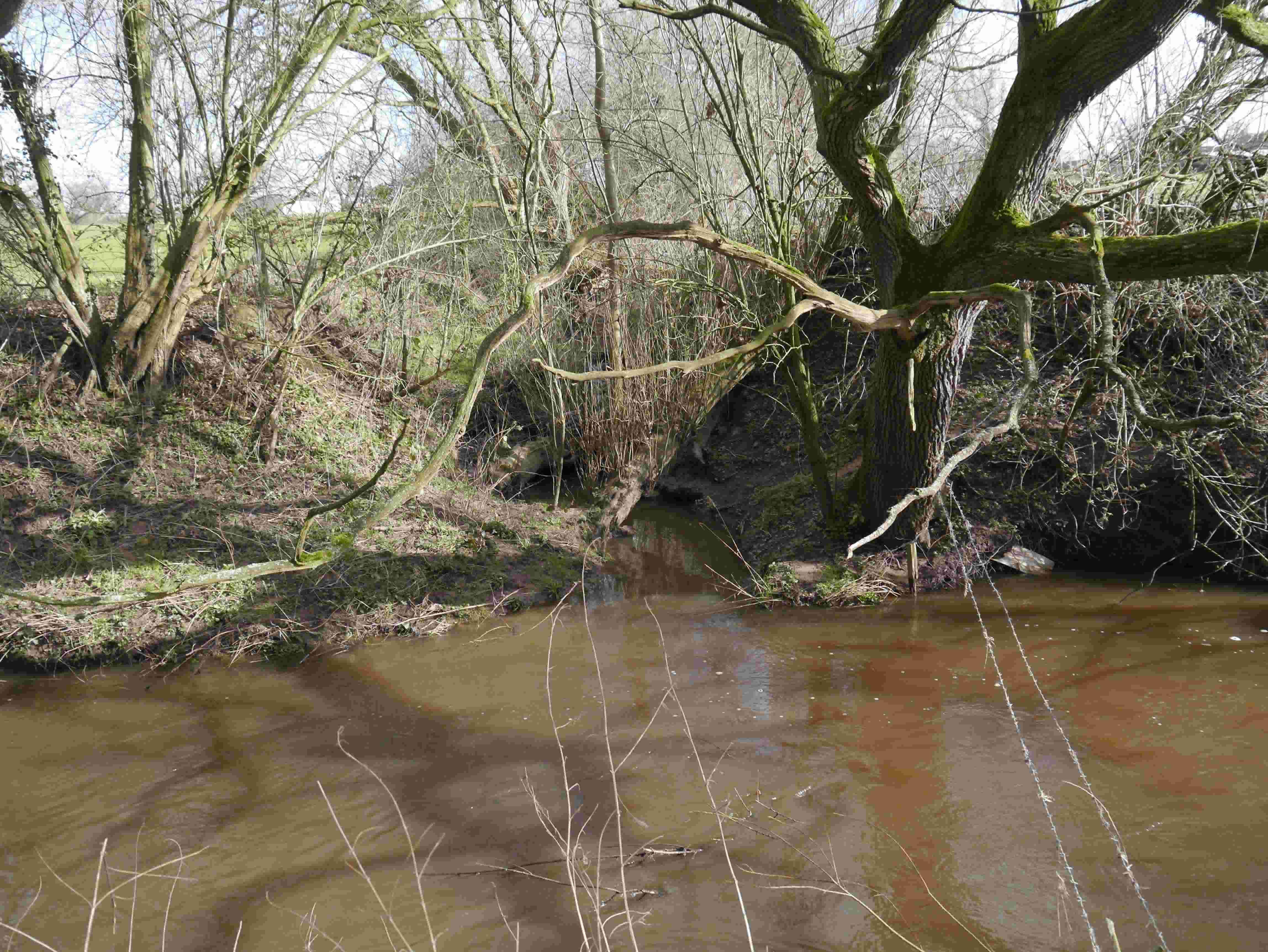
Pic 21 Meander in the brook alongside Greaves Woods. |
 |
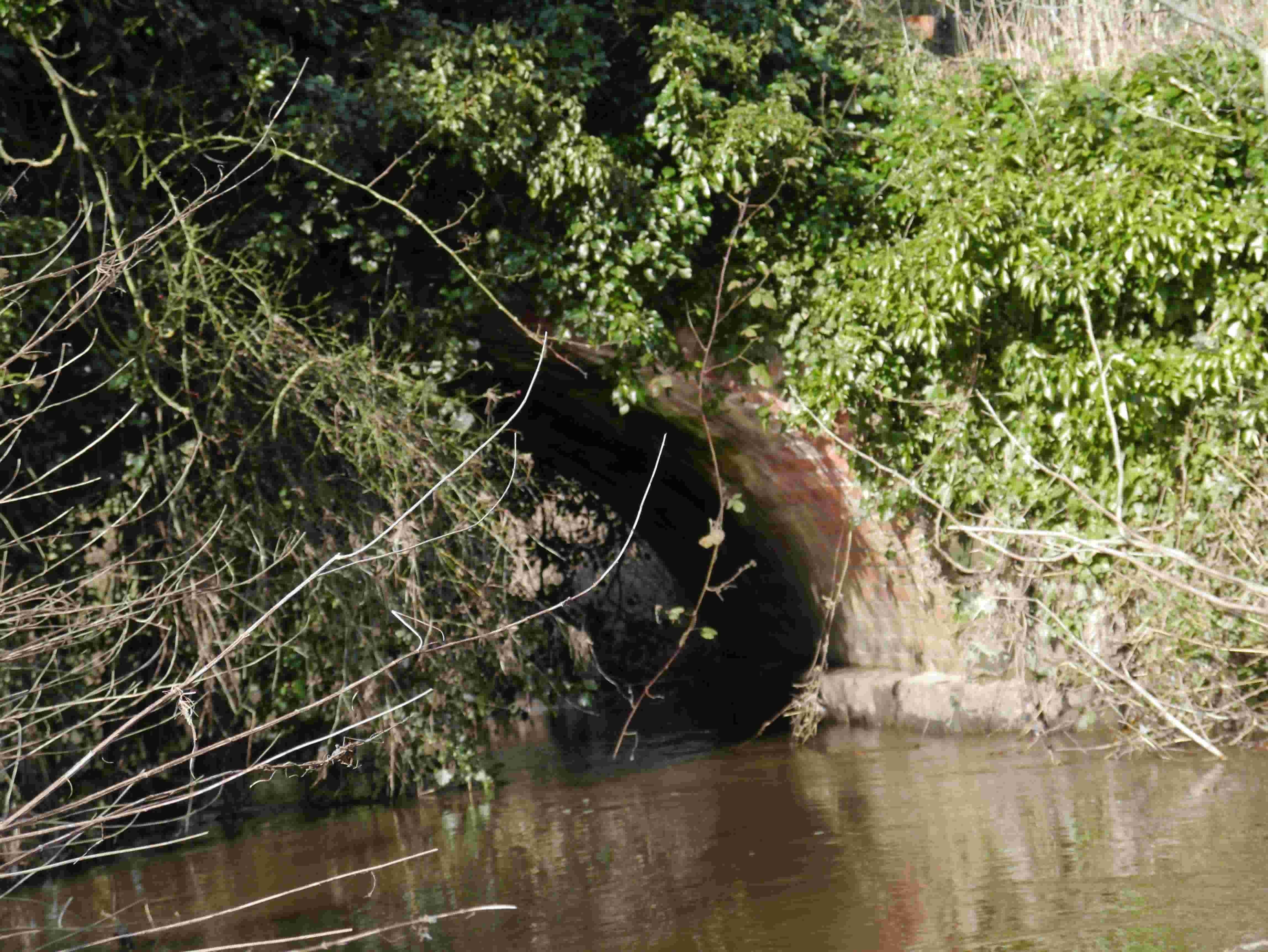
| Pic 22 Alluvial deposits on the North bank. There are several land drains and ditches that discharge into the brook along this section. The Rock Cottage to Greaves Woods footpath traverses a small timber bridge and stile over one of these ditches. |
 |
Pic 23 Recent flood protection works at the Mill and Butler’s Yard from Sarn Bridge. Kingfishers can be seen from the Queen’s Head beer garden during the Summer months perched on a rock near the weir, before darting to catch their next meal. They are likely to nest in cavities in the soft banks of the brook. |
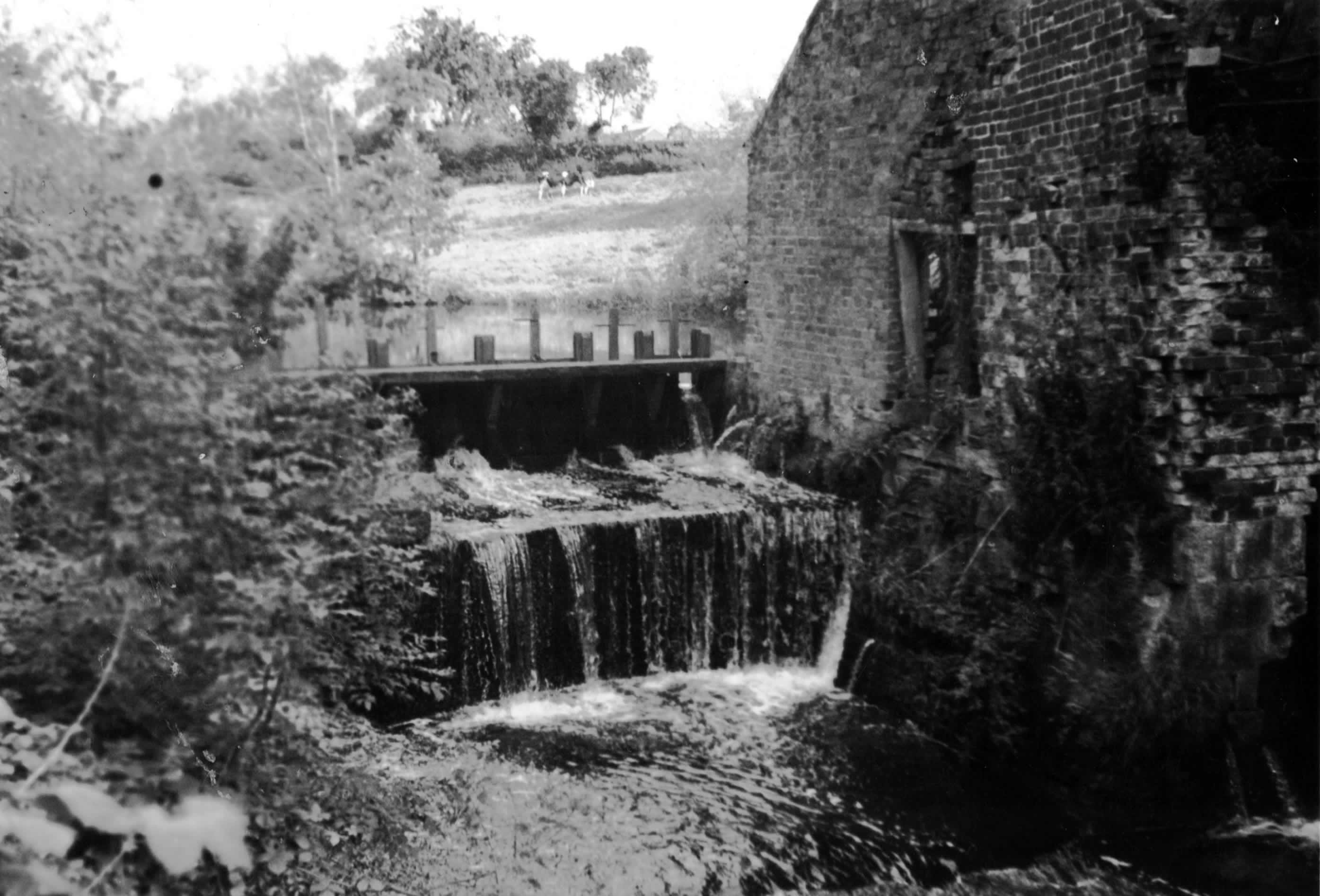 |
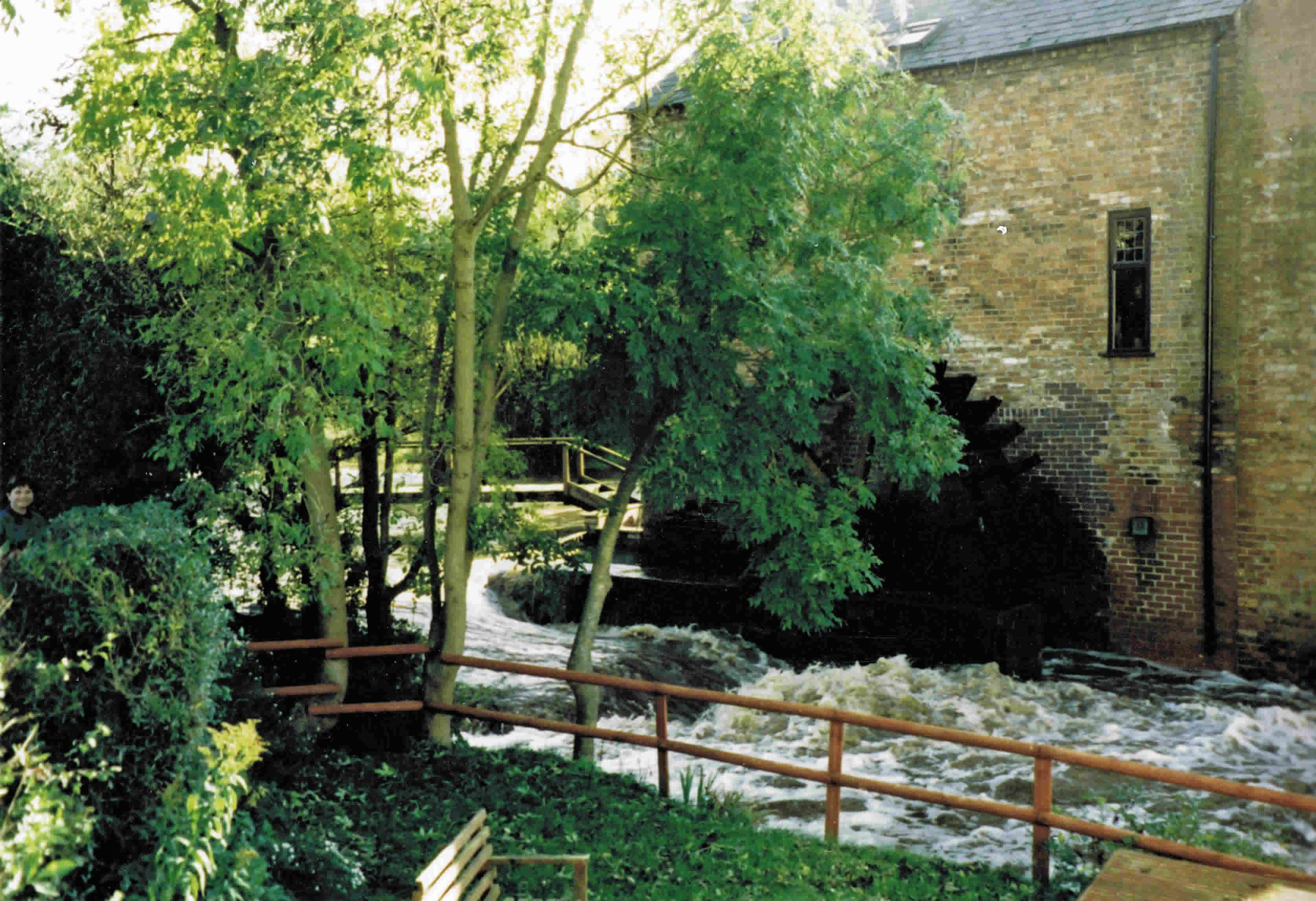
| Pic 24 Wych Brook sluice and weir at Sarn Mill circa 1974 |
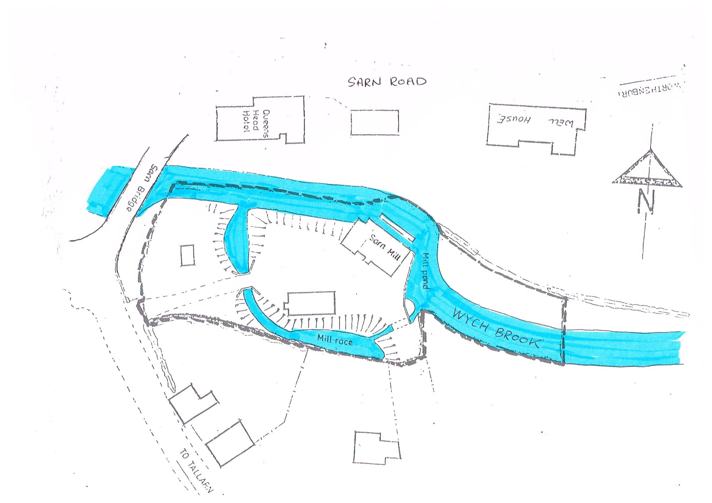 |
| Plan on Wych Brook at Sarn Mill - mid 1980s |
 |
| Pic 25 Wych Brook in full torrent at the Sarn Mill November 1999 |
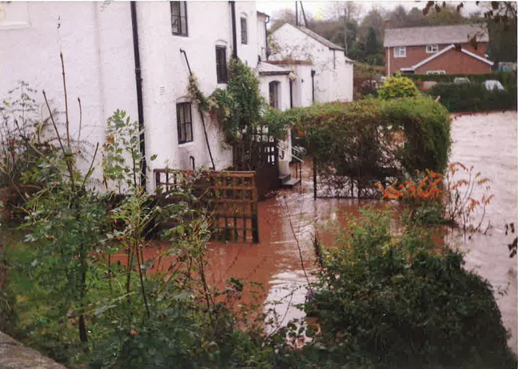 |
| Pic 26 Wych Brook in flood at the Queens Head, Sarn in October 2000. The flood of July 2007 fortunately did not rise to this level. |
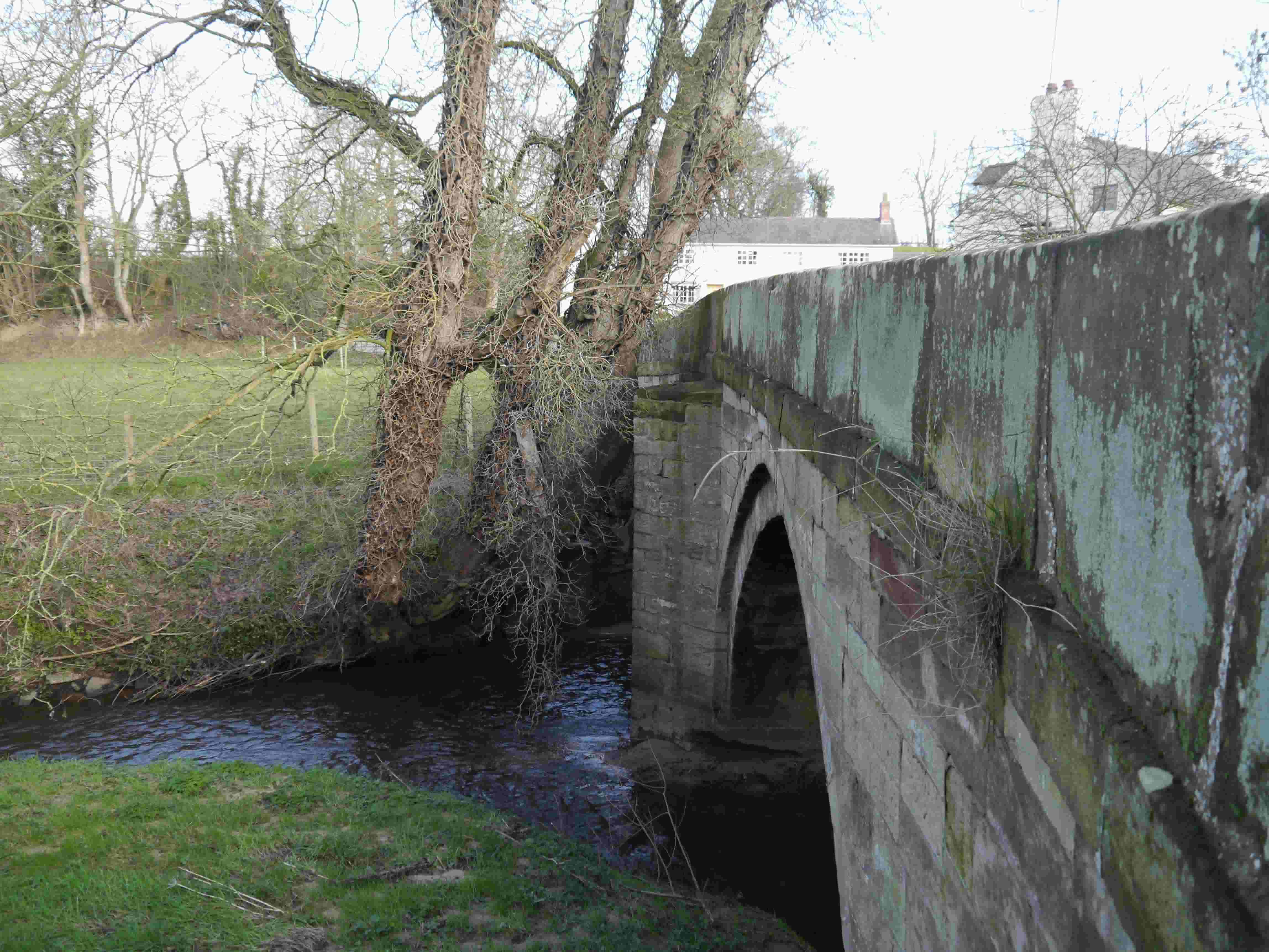 |
| Pic 27 Sarn Bridge from the South West side. A twin segmental masonry arch structure, rebuilt in 1925 from widening works of 1819 to the original 17th century structure. The bridge is noted on the Peter Burdett map of 1777 [5]. At the central pier are pointed starlings – wedge shaped strengthening intended to protect the pier from scour on both upstream and downstream faces and to protect from debris impacting on the upstream face. |
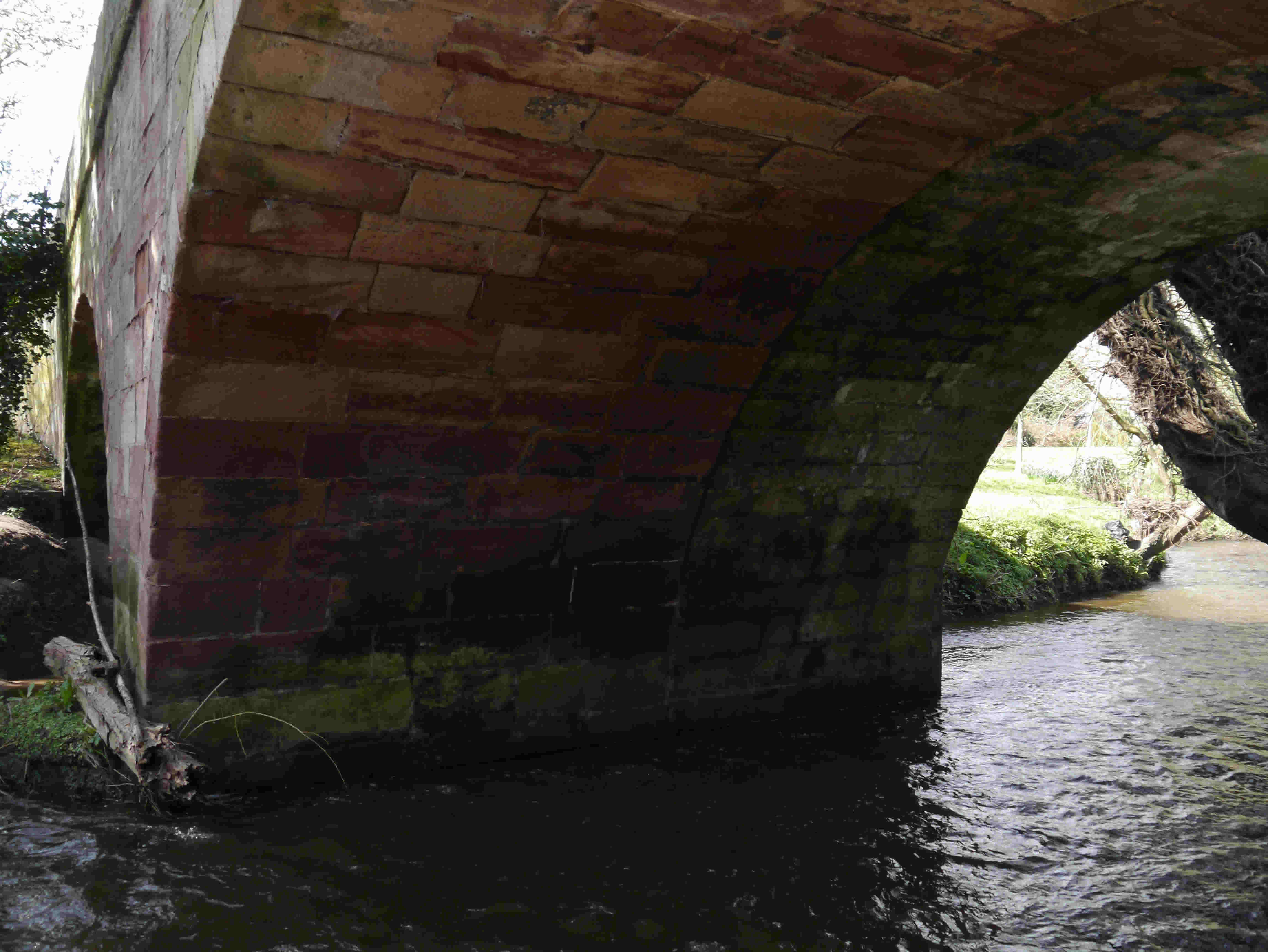 |
| Pic 28 Beneath the North arch barrel. The 19th century widening is on the left and the original 17th century structure is on the right. At the arch intrados, the barrels appear to be structurally separate above springer level and therefore must be tied elsewhere for stability purposes. |
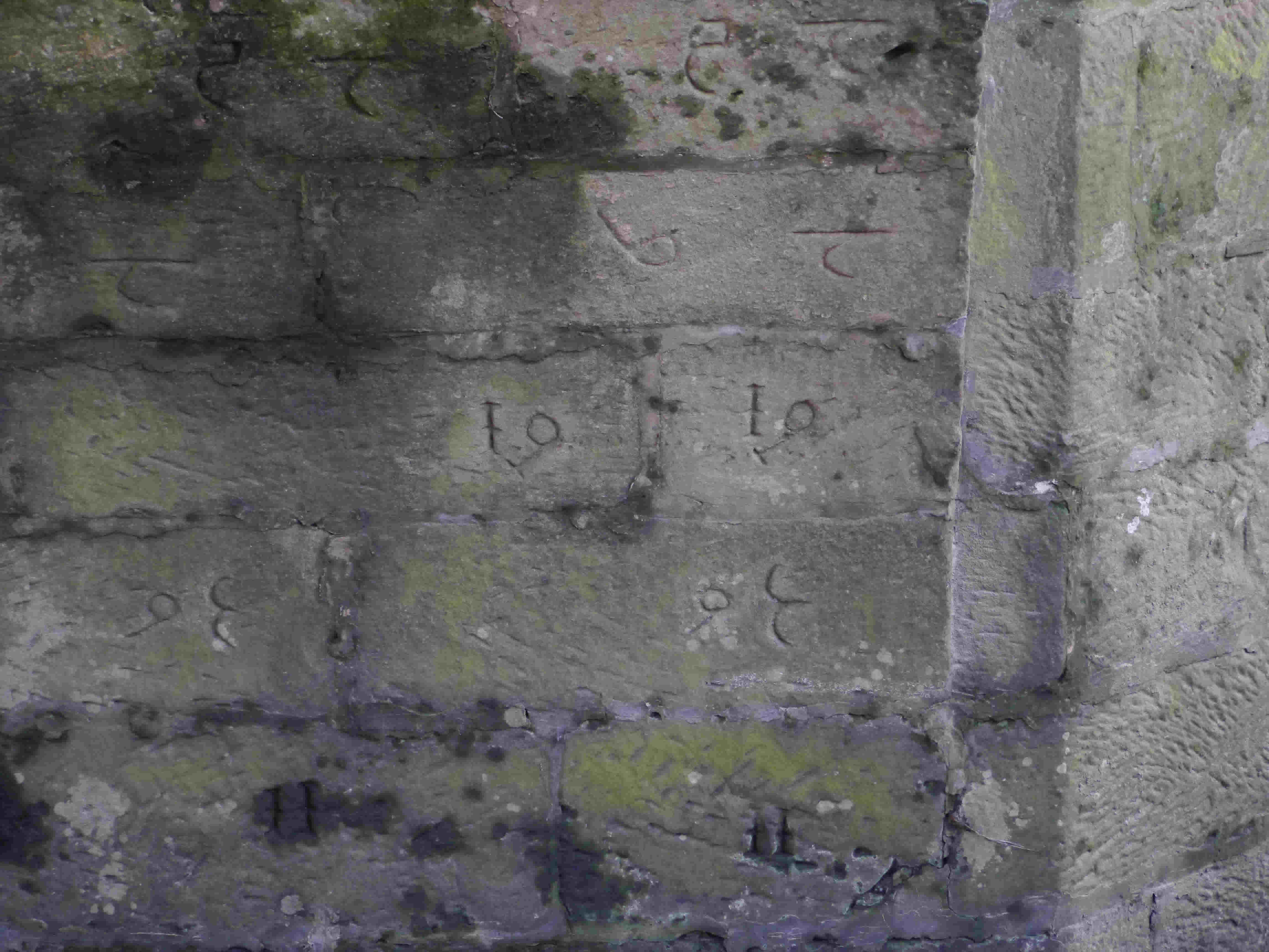 |
| Pic 29 Interesting hieroglyphics. This external marking may indicate the blocks were re-used from another location. Had the blocks been cut to size at the quarry, location marks would have been carved either on the top surface or on the subsequently buried face. |
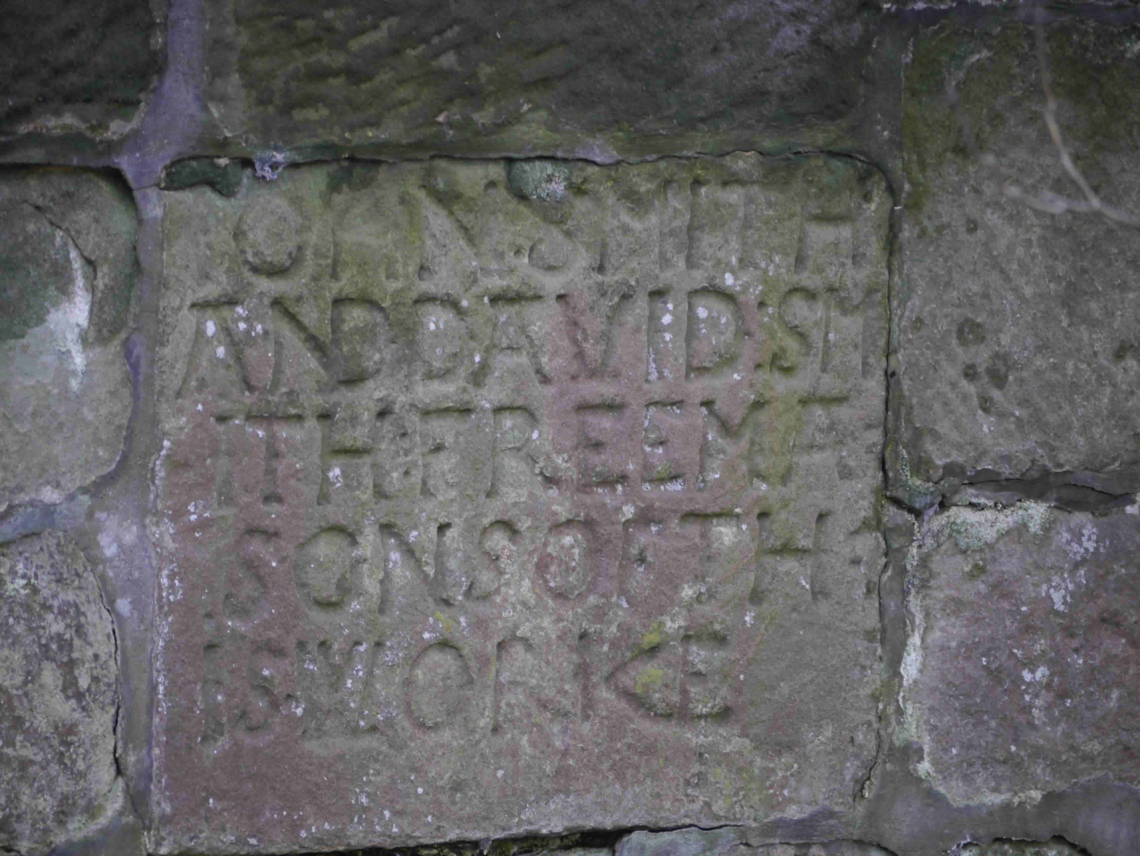 |
| Pic 30 Carved Inscriptions: On the North side of the West spandrel wall the inscription reads - ” John Smith and David Smith : Freemasons of this worke” |
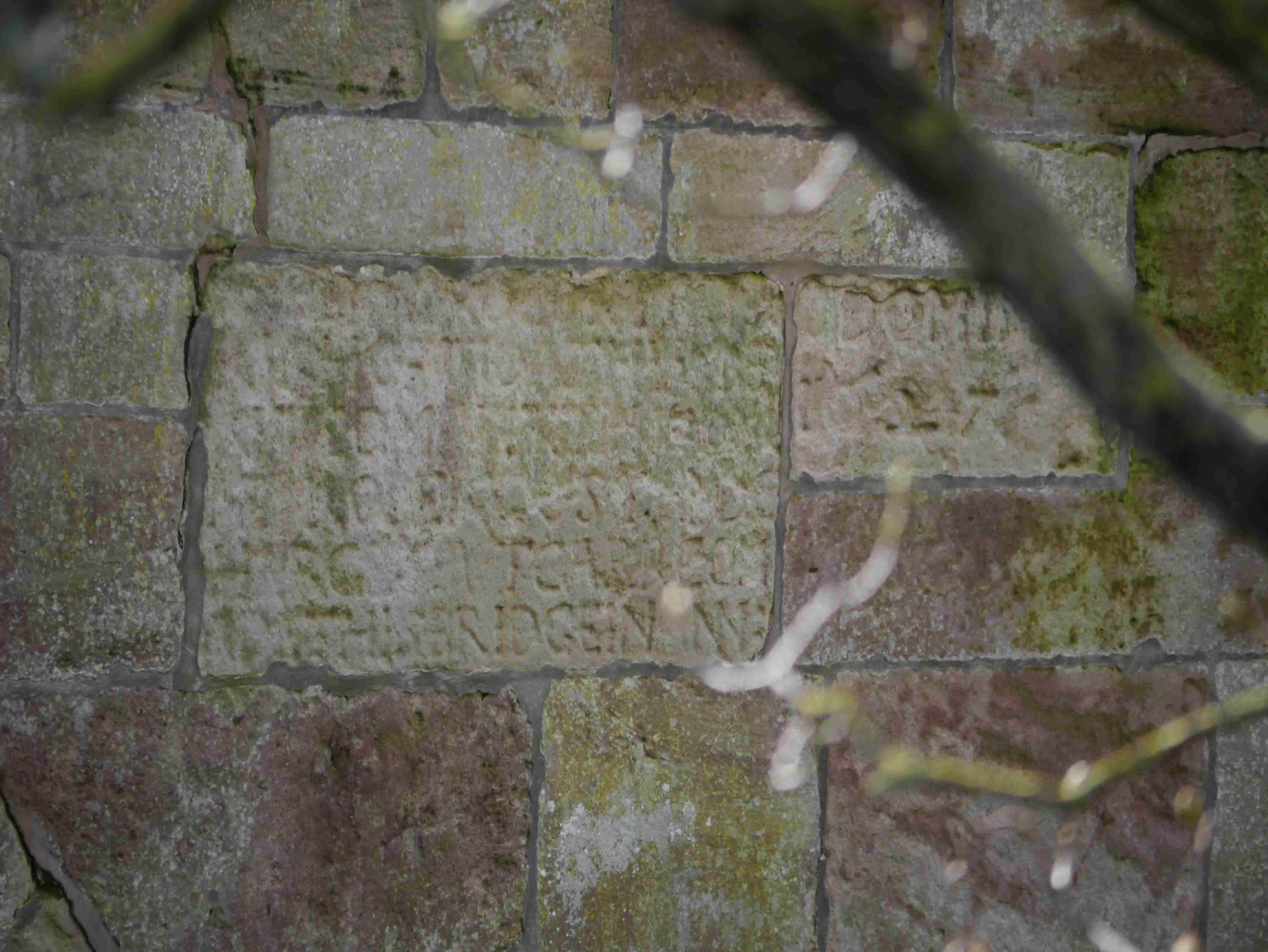 |
| Pic 31 Carved Inscriptions: On the South side of the West spandrel wall the text is weathered and yet to be fully deciphered. |
 |
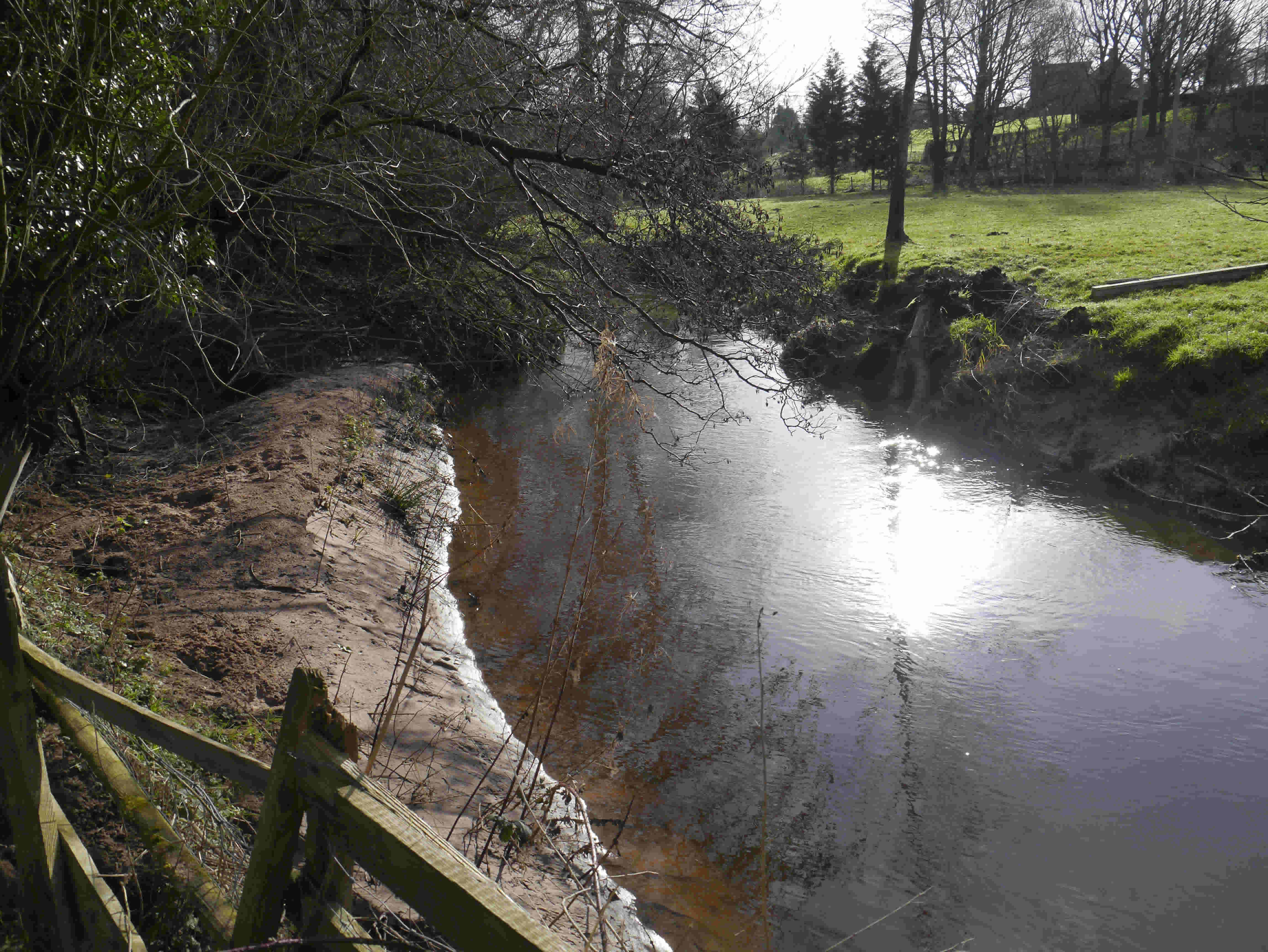
| Pic 32 A looping meander with alluvial silt deposited on the inside of the bend. One of several along the Sarn to Caenant Wood section of the brook. |
 |
| Pic 33 Farm access bridge with composite steel beam and concrete deck on blockwork faced abutments and wingwalls on insitu cast concrete foundations. The west abutment wall is anchored via pattress plates and tie rods into the ground for stability purposes. Estimated age in the order of 50 – 75 years. |
 |
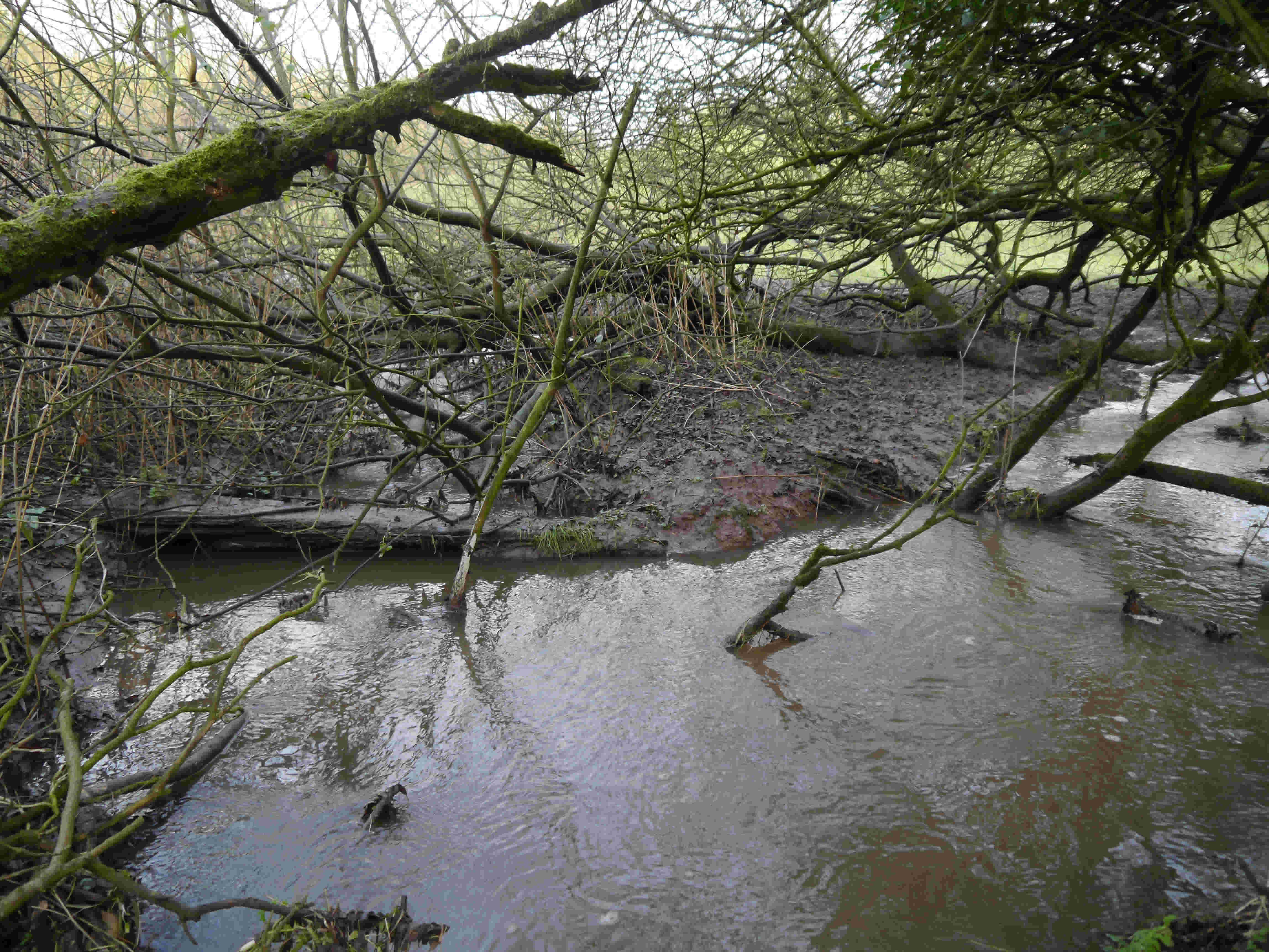
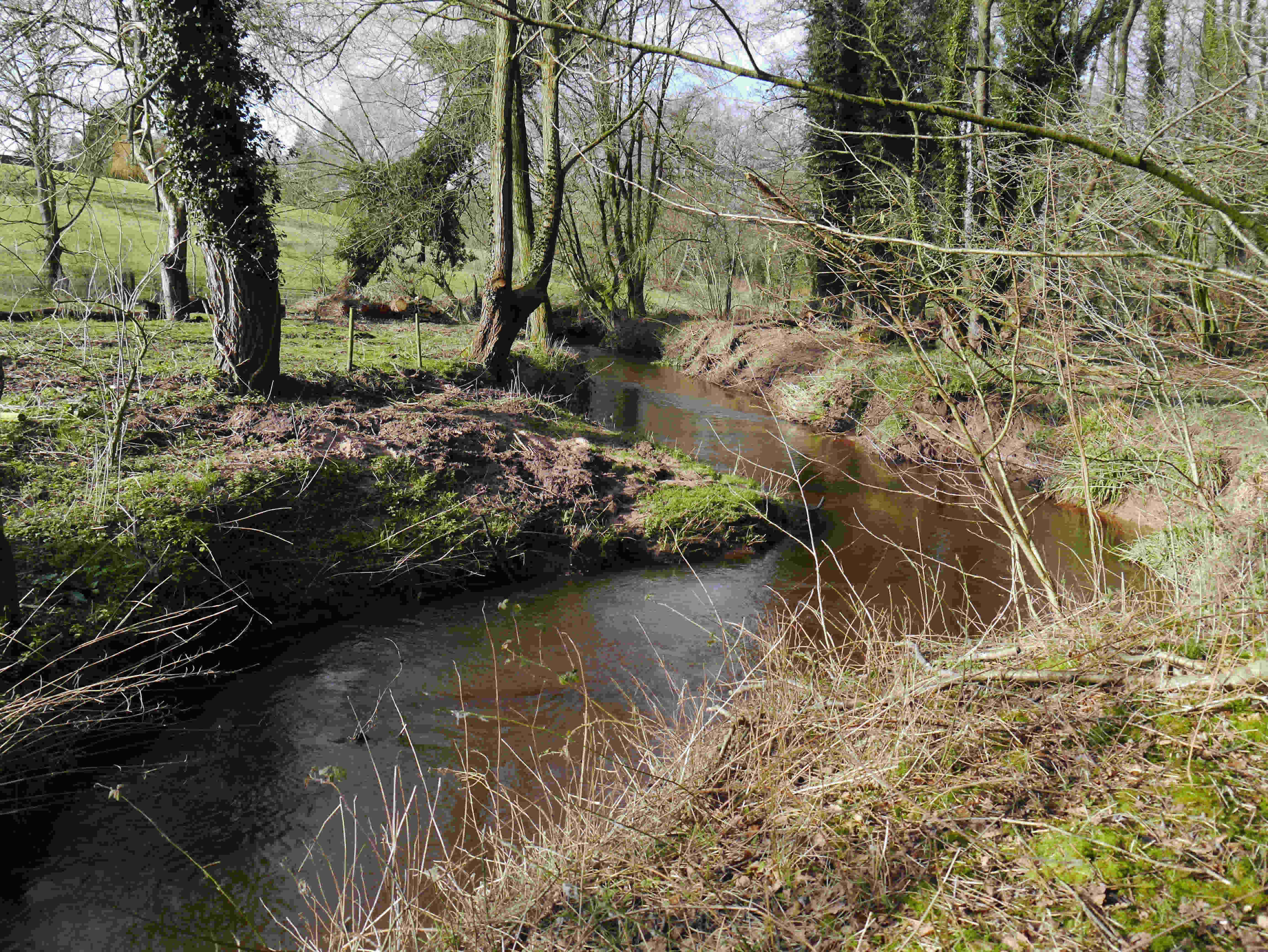
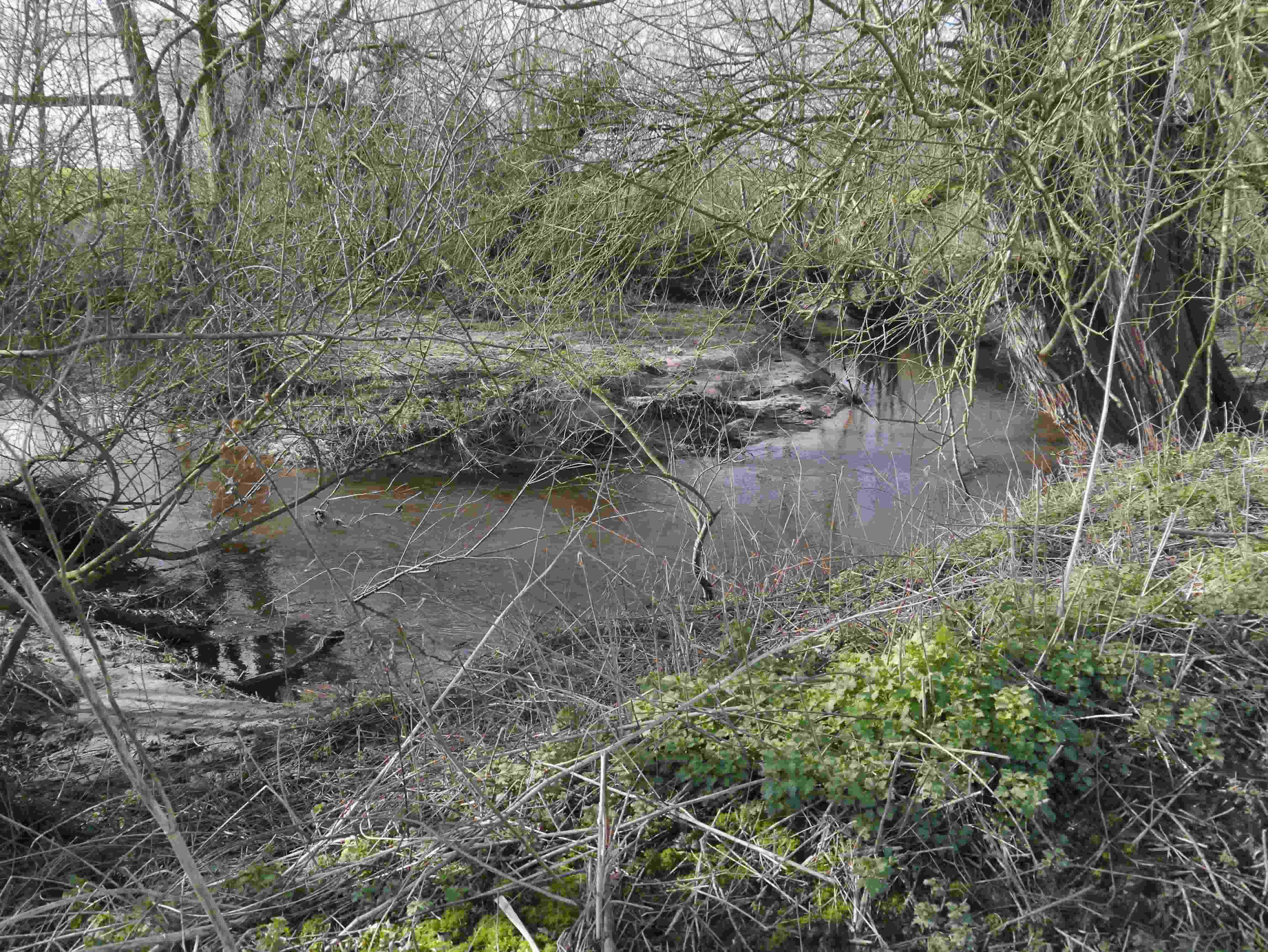
| Pic 34 Confluence of Paradise Brook and Wych Brook. When the trees are in leaf this would be hidden from view. |
 |
| Pic 35 Farm Access bridge near Caenant Wood. Cae and nant translate into field and stream respectively. |
 |
| Pic 36 Farm access bridge. The single semi-circular masonry arch bridge appears to date from the early 19th century. Hand carved stone blocks act as arch springers at water level. Handmade bricks, similar to those produced by the Oldcastle Lane brickworks, form the arch barrel and the South spandrel wall. The North spandrel wall and wingwalls have been rebuilt using Ruabon red engineering bricks, possibly during the early 20th century. Substantial capping stones adorn the parapet walls. In its day, this has been an impressive structure and poses the question as to whether it was originally intended for other than agricultural use. The proximity of the original Broughton Estate and the existing bridle path to Worthenbury may hold a clue. |
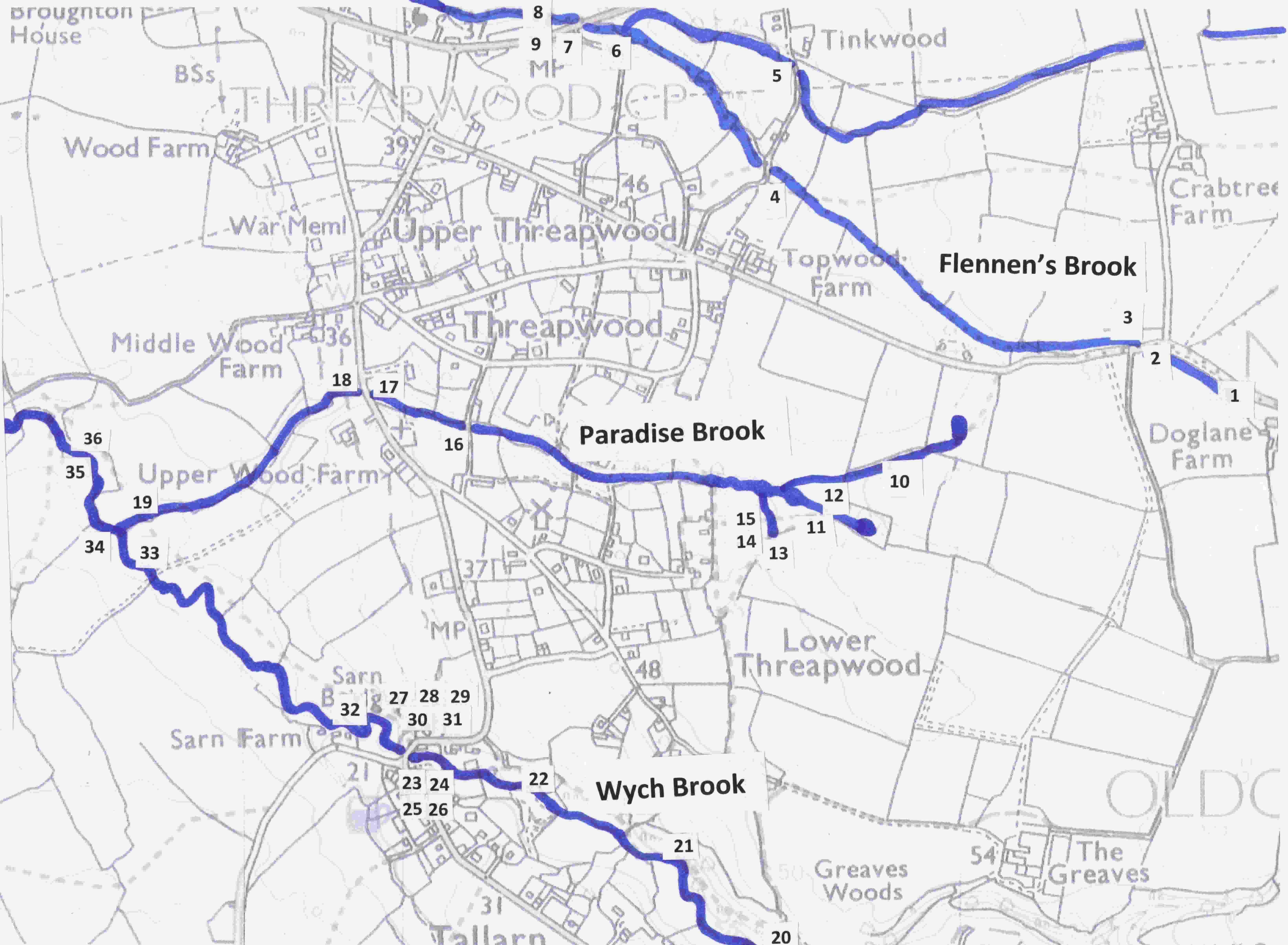 |
| Plan showing photo locations |
Conclusion
Journeys along the watercourses of Threapwood have revealed a wide variety of historical, biological and geographical aspects of interest.
From exploring beneath the engineering splendour of the masonry arch bridges to the wonderful flash of a Kingfisher catching its meal at the Sarn, many surprises have been delivered.
Perhaps this work may provide a taster for further exploration. The History Group welcome any contributions for the purpose of expanding this paper at some future time.
References:
- Geological Survey of Great Britain - Geology of the Country around Nantwich and Whitchurch - Natural Environment Research Council
- Strategic Stone Study – A building stone atlas of Cheshire – English Heritage
- Historic Landscape Characterisation - Maelor Saesneg
- The Place Names of Cheshire Vol 1. John McNeal Dodgson, Cambridge University Press
- Peter Burdett map 1777 – cheshirehistory.org.uk
- Wikipedia – Wych Brook
Thanks to the following for their valued contributions - either by access to their land, historical information or comments:
Andrew Alderson, John Bourne, Brian and Linda Butler, Bob and Shirley Carter, John and Jill Lewis, Richard and Joan Mewes, John Minoprio, Rob and Sue Pickering, Dorothy Powell.